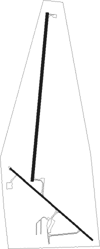
Syracuse - Syracuse-hamilton Co Muni
Airport details
| Country | United States of America |
| State | Kansas |
| Region | K3 |
| Airspace | Denver Ctr |
| Municipality | Hamilton County |
| Elevation | 3326ft (1014m) |
| Timezone | GMT -7 |
| Coordinates | 37.99858, -101.74761 |
| Magnetic var | |
| Type | land |
| Available since | X-Plane v10.40 |
| ICAO code | 3K3 |
| IATA code | n/a |
| FAA code | 3K3 |
Communication
| Syracuse-Hamilton Co Muni CTAF/UNICOM | 122.800 |
Nearby Points of Interest:
Douglas Crossing Bridge
-Granada Bridge (Granada, Colorado)
-Greeley County Courthouse
-Deerfield Texaco Service Station
-Grant County Courthouse District
Nearby beacons
| code | identifier | dist | bearing | frequency |
|---|---|---|---|---|
| ULS | ULYSSES NDB | 30 | 137° | 395 |
| LAA | LAMAR VOR/DME | 45.9 | 282° | 116.90 |
| HQG | HUGOTON NDB | 53.1 | 156° | 365 |
| LBL | LIBERAL VORTAC | 68.2 | 141° | 112.30 |
Instrument approach procedures
| runway | airway (heading) | route (dist, bearing) |
|---|---|---|
| RW18 | ISSOY (192°) | ISSOY 5700ft |
| RW18 | IZUKO (218°) | IZUKO 5700ft ISSOY (5mi, 278°) 5700ft |
| RW18 | OREME (164°) | OREME 5700ft ISSOY (5mi, 98°) 5700ft |
| RNAV | ISSOY 5700ft JULPA (6mi, 192°) 5100ft VEDUY (3mi, 192°) 4120ft 3K3 (3mi, 191°) 3361ft YEKUP (12mi, 192°) 5700ft YEKUP (turn) | |
| RW36 | ISJOJ (343°) | ISJOJ 5700ft YEKUP (5mi, 278°) 5700ft |
| RW36 | WEPUR (39°) | WEPUR 5700ft YEKUP (5mi, 98°) 5700ft |
| RW36 | YEKUP (12°) | YEKUP 5700ft |
| RNAV | YEKUP 5700ft HOTHU (6mi, 12°) 5100ft JUDOL (3mi, 12°) 4020ft 3K3 (2mi, 13°) 3359ft (5960mi, 110°) 3568ft ISSOY (5956mi, 291°) 5700ft ISSOY (turn) |
Disclaimer
The information on this website is not for real aviation. Use this data with the X-Plane flight simulator only! Data taken with kind consent from X-Plane 12 source code and data files. Content is subject to change without notice.

