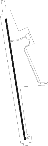
Coldwater - Comanche County
Airport details
| Country | United States of America |
| State | Kansas |
| Region | K3 |
| Airspace | Kansas City Ctr |
| Municipality | Comanche County |
| Elevation | 2083ft (635m) |
| Timezone | GMT -6 |
| Coordinates | 37.22286, -99.33203 |
| Magnetic var | |
| Type | land |
| Available since | X-Plane v10.40 |
| ICAO code | 3K8 |
| IATA code | n/a |
| FAA code | n/a |
Communication
| Comanche County CTAF | 122.900 |
Nearby Points of Interest:
Fromme-Birney Round Barn
-Stein House
-Stockgrowers State Bank
-Girl Scout Little House
-Harper County Courthouse
-Big Basin Prairie Preserve
Runway info
| Runway 17 / 35 | ||
| length | 1375m (4511ft) | |
| bearing | 174° / 354° | |
| width | 18m (60ft) | |
| surface | concrete | |
Nearby beacons
| code | identifier | dist | bearing | frequency |
|---|---|---|---|---|
| DDC | DODGE CITY VORTAC | 49.4 | 313° | 108.20 |
| MMB | MITBEE (GAGE) VORTAC | 59 | 212° | 115.60 |
Instrument approach procedures
| runway | airway (heading) | route (dist, bearing) |
|---|---|---|
| RW17 | DUKRE (174°) | DUKRE 4600ft |
| RW17 | EGANE (150°) | EGANE DUKRE (7mi, 111°) 4600ft |
| RW17 | FAXUL (199°) | FAXUL DUKRE (7mi, 241°) 4600ft |
| RNAV | DUKRE 4600ft ATTAD (8mi, 174°) 3600ft CAGIM (2mi, 174°) 2880ft 3K8 (3mi, 174°) 2126ft (5851mi, 111°) 2447ft GECKS (5851mi, 290°) 4600ft GECKS (turn) | |
| RW35 | GECKS (354°) | GECKS 4600ft |
| RW35 | IDICU (19°) | IDICU GECKS (7mi, 61°) 4600ft |
| RW35 | JANAX (330°) | JANAX GECKS (7mi, 291°) 4600ft |
| RNAV | GECKS 4600ft BOGVE (8mi, 354°) 3600ft HAGMI (2mi, 354°) 2860ft 3K8 (3mi, 354°) 2114ft (5851mi, 111°) 2443ft DUKRE (5850mi, 291°) 4600ft DUKRE (turn) |
Disclaimer
The information on this website is not for real aviation. Use this data with the X-Plane flight simulator only! Data taken with kind consent from X-Plane 12 source code and data files. Content is subject to change without notice.
