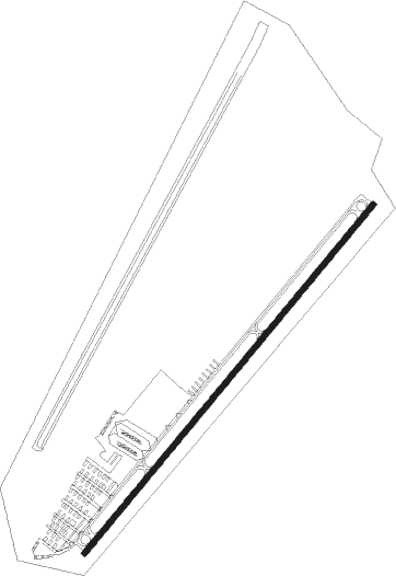
Old Bridge
Airport details
| Country | United States of America |
| State | New Jersey |
| Region | K6 |
| Airspace | New York Ctr |
| Municipality | Old Bridge Township |
| Elevation | 85ft (26m) |
| Timezone | GMT -5 |
| Coordinates | 40.32989, -74.34679 |
| Magnetic var | |
| Type | land |
| Available since | X-Plane v10.40 |
| ICAO code | 3N6 |
| IATA code | n/a |
| FAA code | 3N6 |
Communication
| Old Bridge CTAF | 123.075 |
| Old Bridge MC QUIRE Approach/Departure | 124.475 |
Nearby Points of Interest:
Buckelew Mansion
-St. Peters Church and Buildings
-Court Street School
-Church Street School
-Hankinson-Moreau-Covenhoven House
-Cedar Grove School
-Old Kentuck
-Pigeon Swamp State Park
-Probasco-Dittner Farmstead
-Kovenhoven
-Old School Baptist Church and Cemetery
-Upper Meeting House of the Baptist Church of Middletown
-Holmdel Dutch Reformed Church
-Roosevelt
-Clarksburg School
-Clarksburg Methodist Episcopal Church
-Thomas I. Agnew House
-Wood Lawn
-Levi D. Jarrard House
-William H. Johnson House
-Union Schoolhouse
-Livingston Avenue Historic District
-Henry Guest House
-Main Post Office
-Ward's Point
Nearby beacons
| code | identifier | dist | bearing | frequency |
|---|---|---|---|---|
| COL | COLTS NECK VOR/DME | 8.6 | 96° | 115.40 |
| RBV | ROBBINSVILLE VORTAC | 10.2 | 229° | 113.80 |
| NEL | LAKEHURST NDB | 17.1 | 178° | 396 |
| NEL | LAKEHURST TACAN | 17.5 | 181° | 111.80 |
| GXU | MC GUIRE (WRIGHTSTOWN) VORTAC | 22.3 | 218° | 110.60 |
| SBJ | SOLBERG VOR/DME | 23.6 | 303° | 112.90 |
| CAT | CHATHAM NDB | 24.9 | 349° | 254 |
| ARD | YARDLEY VOR/DME | 26 | 262° | 108.20 |
| CRI | CANARSIE VOR/DME | 26.7 | 58° | 112.30 |
| TE | TORBY (TETERBORO) NDB | 30.1 | 24° | 214 |
| CYN | COYLE VORTAC | 31 | 189° | 113.40 |
| JFK | KENNEDY (NEW YORK) VOR/DME | 31.9 | 62° | 115.90 |
| MM | MOREE (MORRISTOWN) NDB | 33 | 1° | 392 |
| TEB | TETERBORO VOR/DME | 33.7 | 29° | 108.40 |
| LGA | LA GUARDIA (NEW YORK) VOR/DME | 34.9 | 46° | 113.10 |
| BWZ | BROADWAY (SCHOOLEY'S MT) VOR/DME | 35.5 | 315° | 114.20 |
| ING | AMBLER NDB | 44.7 | 258° | 275 |
| SAX | SPARTA VORTAC | 45.1 | 345° | 115.70 |
| STW | STILLWATER VOR/DME | 46.5 | 322° | 109.60 |
| FR | FRIKK (FARMINGDALE) NDB | 47.6 | 63° | 407 |
| ACY | ATLANTIC CITY VORTAC | 53.5 | 195° | 108.60 |
| VCN | CEDAR LAKE (MILLVILLE) VOR/DME | 55.4 | 218° | 115.20 |
| OOD | WOODSTOWN VORTAC | 60.6 | 234° | 112.80 |
| RNB | RAINBOW (MILLVILLE) NDB | 65.7 | 221° | 363 |
| CMK | CARMEL VOR/DME | 66.8 | 39° | 116.60 |
Instrument approach procedures
| runway | airway (heading) | route (dist, bearing) |
|---|---|---|
| RW06 | RBV (49°) | RBV 6000ft RBV (turn) 1700ft |
| RNAV | RBV 1700ft ARIAN (5mi, 47°) 1700ft 3N6 (5mi, 52°) 106ft (4692mi, 118°) 487ft AMADE (4689mi, 299°) COL (7mi, 126°) 2000ft COL (turn) | |
| RW24 | RBV (49°) | RBV KUNVE (21mi, 51°) 1800ft KUNVE (turn) 1800ft |
| RNAV | KUNVE 1800ft AMADE (6mi, 232°) 1700ft 3N6 (5mi, 232°) 122ft (4692mi, 118°) 487ft COL (4684mi, 299°) 2000ft COL (turn) |
Disclaimer
The information on this website is not for real aviation. Use this data with the X-Plane flight simulator only! Data taken with kind consent from X-Plane 12 source code and data files. Content is subject to change without notice.
