Grand Lake Regl
Airport details
| Country | United States of America |
| State | Oklahoma |
| Region | K4 |
| Airspace | Kansas City Ctr |
| Municipality | Delaware County |
| Elevation | 791ft (241m) |
| Timezone | GMT -6 |
| Coordinates | 36.57758, -94.86190 |
| Magnetic var | |
| Type | land |
| Available since | X-Plane v10.40 |
| ICAO code | 3O9 |
| IATA code | n/a |
| FAA code | n/a |
Communication
| Grand Lake Regl CTAF/UNICOM | 122.700 |
Nearby Points of Interest:
Corey House/Hotel
-Splitlog Church
-Pensacola Dam
-McDougal Filling Station
-Attucks School
-Randall Tire Company
-Miami Marathon Oil Company Service Station
-Adar House
-John Patrick McNaughton Barn
-Coats School
-Wee Pine Knot
-Sulphur Springs Old School Complex Historic District
-Jones House
-Sulphur Springs Park Reserve
-Shiloh House
-Coon Creek Bridge
-Kindley House
-Hildebrand Mill
-Bolin Barn and Smokehouse
-Mitchell-Ward House
-Railroad Cottage
-Carl House
-Mitchell House
-Carpenter Building
-Bank of Gentry
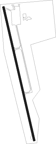
Runway info
| Runway 17 / 35 | ||
| length | 1204m (3950ft) | |
| bearing | 169° / 349° | |
| width | 18m (60ft) | |
| surface | concrete | |
| displ threshold | 70m (230ft) / 68m (223ft) | |
Nearby beacons
| code | identifier | dist | bearing | frequency |
|---|---|---|---|---|
| EOS | NEOSHO VOR/DME | 25.9 | 58° | 117.30 |
| SLG | SILOAM SPRINGS NDB | 29.4 | 136° | 284 |
| OSW | OSWEGO VOR/DME | 38.5 | 329° | 117.60 |
| JL | LUNNS (JOPLIN) NDB | 40.2 | 26° | 344 |
| RZC | RAZORBACK (FAYETTEVILLE) VORTAC | 40.9 | 114° | 116.40 |
| TUL | TULSA VORTAC | 50.2 | 248° | 114.40 |
Disclaimer
The information on this website is not for real aviation. Use this data with the X-Plane flight simulator only! Data taken with kind consent from X-Plane 12 source code and data files. Content is subject to change without notice.