Boyceville - Boyceville Muni
Airport details
| Country | United States of America |
| State | Wisconsin |
| Region | K5 |
| Airspace | Minneapolis Ctr |
| Municipality | Boyceville |
| Elevation | 963ft (294m) |
| Timezone | GMT -6 |
| Coordinates | 45.04395, -92.02132 |
| Magnetic var | |
| Type | land |
| Available since | X-Plane v10.40 |
| ICAO code | 3T3 |
| IATA code | n/a |
| FAA code | n/a |
Communication
| Boyceville Muni CTAF/UNICOM | 122.800 |
Nearby Points of Interest:
Louis Smith Tainter House
-Colfax Municipal Building
-Marcus Sears Bell Farm
-William J. Bernd House
-Dr. Frank W. Epley Office
-New Richmond News Building
-Edward N. and Mary T. Stebbins House
-Erick J. Thompson House
-New Richmond West Side Historic District
-First English Lutheran Church
-Kinnickinnic Church
-James Stephen Hoover and Elizabeth Borland Memorial Chapel
-Oatman Filling Station
-Levi Merrill House
-Brady Anderson and Waldemar Ager House
-Soo Line 2719
-Eau Claire Vocational School
-St. Patrick's Church
-Salsbury Row House
-Barnes Block
-Confluence Commercial Historic District
-Community House, First Congregational Church
-Eau Claire Public Library
-Antique Emporium
Runway info
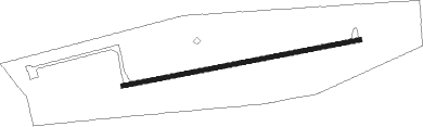
| Runway 8 / 26 | ||
| length | 1006m (3301ft) | |
| bearing | 85° / 265° | |
| width | 18m (60ft) | |
| surface | asphalt | |
Nearby beacons
| code | identifier | dist | bearing | frequency |
|---|---|---|---|---|
| RP | WICKR (RICE LAKE) NDB | 18.8 | 39° | 221 |
| EAU | EAU CLAIRE VORTAC | 24.6 | 105° | 113.65 |
| RG | REGUE (RED WING) NDB | 37.8 | 235° | 274 |
| BXR | BIG DOCTOR (SIREN) NDB | 48.8 | 336° | 203 |
| RZN | DME | 48.9 | 336° | 109.40 |
| ROS | RUSH CITY NDB | 55.5 | 305° | 282 |
| HYR | DME | 63.3 | 31° | 113.40 |
Instrument approach procedures
| runway | airway (heading) | route (dist, bearing) |
|---|---|---|
| RW08 | AGUDE (103°) | AGUDE JANAR (8mi, 139°) 2800ft |
| RW08 | BITLR (62°) | BITLR JANAR (8mi, 11°) 2800ft |
| RW08 | JANAR (85°) | JANAR 2800ft |
| RNAV | JANAR 2800ft IBIPE (6mi, 85°) 2800ft MILGE (2mi, 85°) 2280ft 3T3 (4mi, 85°) 992ft (5491mi, 116°) 1367ft JANAR (5503mi, 296°) 2800ft JANAR (turn) | |
| RW26 | EAU (285°) | EAU TUCOR (15mi, 302°) 3200ft |
| RW26 | ENTAF (222°) | ENTAF TUCOR (22mi, 191°) 3200ft |
| RNAV | TUCOR 3200ft OBIRE (6mi, 266°) 2800ft 3T3 (6mi, 265°) 1007ft (5491mi, 116°) 1333ft JANAR (5503mi, 296°) 2800ft JANAR (turn) |
Disclaimer
The information on this website is not for real aviation. Use this data with the X-Plane flight simulator only! Data taken with kind consent from X-Plane 12 source code and data files. Content is subject to change without notice.