Valle
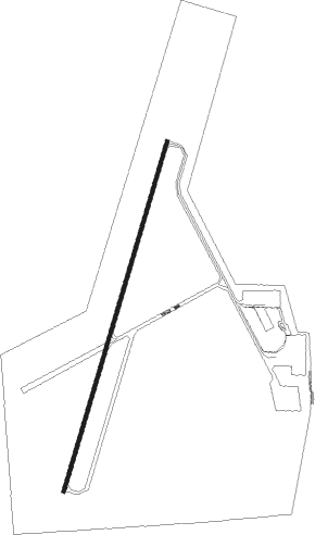
Airport details
| Country | United States of America |
| State | Arizona |
| Region | K2 |
| Airspace | Los Angeles Ctr |
| Municipality | Coconino |
| Elevation | 5999ft (1828m) |
| Timezone | GMT -7 |
| Coordinates | 35.64868, -112.14176 |
| Magnetic var | |
| Type | land |
| Available since | X-Plane v10.40 |
| ICAO code | 40G |
| IATA code | n/a |
| FAA code | n/a |
Communication
| Valle CTAF/UNICOM | 122.800 |
| Valle L.A. CENTER | 124.850 |
Nearby Points of Interest:
Grand Canyon Railway
-Arizona Trail
-Tusayan Lookout Tree
-Hull Tank Lookout Tree
-Moqui Ranger Station
-Kendrick Mountain Fire Lookout Cabin
-Hull Cabin Historic District
-Grandview Mine
-Grand Canyon Water Reclamation Plant
-Urban Route 66, Williams
-Grand Canyon South Rim Ranger's Dormitory
-Grand Canyon Park Operations Building
-El Tovar Stables
-Grand Canyon Village Historic District
-Grand Canyon Power House
-Grand Canyon National Park Superintendent's Residence
-Bright Angel Trail
-Lookout Studio
-Hopi House
-Camp Clover Ranger Station
-Tusayan Ruins
-River Trail
-Grand Canyon
-Trans-Canyon Telephone Line
-Desert View Watchtower Historic District
Nearby beacons
| code | identifier | dist | bearing | frequency |
|---|---|---|---|---|
| GCN | GRAND CANYON VOR/DME | 18.7 | 359° | 111.65 |
| FLG | FLAGSTAFF VOR/DME | 37.8 | 137° | 113.85 |
| TBC | TUBA CITY VORTAC | 51 | 62° | 113.50 |
| DRK | DRAKE (PRESCOTT) VORTAC | 59.2 | 200° | 114.10 |
Instrument approach procedures
| runway | airway (heading) | route (dist, bearing) |
|---|---|---|
| RW01 | BISOP (77°) | BISOP CAJLA (6mi, 121°) 8800ft JUDDU (5mi, 107°) 7800ft |
| RW01 | FLG (317°) | FLG JOKUD (28mi, 302°) 11500ft JUDDU (6mi, 302°) 8900ft |
| RNAV | JUDDU 7800ft IVLEC (5mi, 25°) 7500ft 40G (5mi, 29°) 6039ft (6476mi, 108°) 6399ft GCN (6472mi, 288°) 10000ft GCN (turn) | |
| RW19 | GCN (179°) | GCN EHGUY (10mi, 153°) 8500ft |
| RNAV | EHGUY 8500ft VALEQ (5mi, 205°) 7900ft 40G (5mi, 201°) 6039ft (6476mi, 108°) 7000ft GCN (6472mi, 288°) 10000ft GCN (turn) |
Disclaimer
The information on this website is not for real aviation. Use this data with the X-Plane flight simulator only! Data taken with kind consent from X-Plane 12 source code and data files. Content is subject to change without notice.