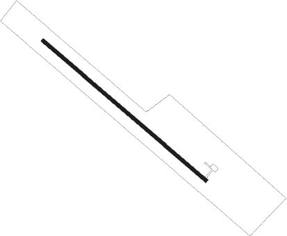
Cherryfield - Deblois Flight Strip
Airport details
| Country | United States of America |
| State | Maine |
| Region | K6 |
| Airspace | Boston Ctr |
| Municipality | Deblois |
| Elevation | 215ft (66m) |
| Timezone | GMT -5 |
| Coordinates | 44.72642, -67.99072 |
| Magnetic var | |
| Type | land |
| Available since | X-Plane v10.40 |
| ICAO code | 43B |
| IATA code | n/a |
| FAA code | n/a |
Communication
| Deblois Flight Strip CTAF | 122.900 |
Runway info
| Runway 15 / 33 | ||
| length | 1371m (4498ft) | |
| bearing | 126° / 306° | |
| width | 23m (75ft) | |
| surface | asphalt | |
| blast zone | 191m (627ft) / 191m (627ft) | |
Nearby beacons
| code | identifier | dist | bearing | frequency |
|---|---|---|---|---|
| PNN | DME | 38.1 | 25° | 114.30 |
| BGR | BANGOR VORTAC | 38.2 | 277° | 114.80 |
| MLT | MILLINOCKET VOR/DME | 56.2 | 329° | 117.90 |
| LNT | MILNOT (MILLINOCKET) NDB | 60.2 | 329° | 344 |
Departure and arrival routes
| Transition altitude | 18000ft |
| Transition level | 18000ft |
| SID end points | distance | outbound heading | |
|---|---|---|---|
| RW33 | |||
| DEBLO1 | 27mi | 231° | |
Instrument approach procedures
| runway | airway (heading) | route (dist, bearing) |
|---|---|---|
| RWNVA | DAANK (306°) | DAANK 3000ft |
| RWNVA | MEEMS (282°) | MEEMS DAANK (5mi, 235°) 3000ft |
| RWNVA | PAATI (337°) | PAATI DAANK (5mi, 55°) 3000ft |
| RNAV | DAANK 3000ft SEVIE (5mi, 306°) 1600ft 43B (5mi, 306°) 248ft (4478mi, 123°) 618ft DAANK (4469mi, 303°) 3000ft DAANK (turn) 3000ft |
Disclaimer
The information on this website is not for real aviation. Use this data with the X-Plane flight simulator only! Data taken with kind consent from X-Plane 12 source code and data files. Content is subject to change without notice.
