Marion - Marion Muni
Airport details
| Country | United States of America |
| State | Kansas |
| Region | |
| Airspace | Kansas City Ctr |
| Municipality | Marion |
| Elevation | 1390ft (424m) |
| Timezone | GMT -6 |
| Coordinates | 38.34091, -96.98714 |
| Magnetic var | |
| Type | land |
| Available since | X-Plane v10.40 |
| ICAO code | 43K |
| IATA code | n/a |
| FAA code | 43K |
Communication
Nearby Points of Interest:
Marion County Courthouse
-Harvey House (Florence, Kansas)
-Peabody Historical Library Museum
-Peabody Township Library
-W.H. Morgan House
-Peabody Downtown Historic District
-Peabody City Park
-Canton Township Carnegie Library
-Chase County Courthouse
-Crocker Ranch
-Warkentin House
-Carnegie Library
-Fischer Field Stadium
-First Baptist Church of Council Grove
-Last Chance Store
-Kaw Mission
-Council Grove Historic District
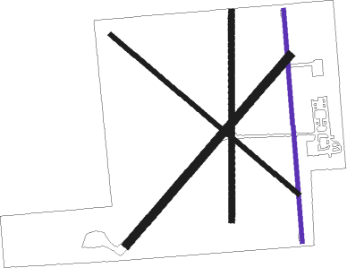
Runway info
| Runway 17 / 35 | ||
| length | 784m (2572ft) | |
| bearing | 180° / 360° | |
| width | 14m (45ft) | |
| surface | asphalt | |
Runway 03 / 21  | ||
| length | 838m (2749ft) | |
| bearing | 52° / 232° | |
| width | 29m (95ft) | |
| surface | grass | |
| Runway 13 / 31 | ||
| length | 831m (2726ft) | |
| bearing | 128° / 308° | |
| width | 15m (50ft) | |
| surface | grass | |
| Runway 18 / 36 | ||
| length | 704m (2310ft) | |
| bearing | 186° / 6° | |
| width | 20m (67ft) | |
| surface | grass | |
Nearby beacons
| code | identifier | dist | bearing | frequency |
|---|---|---|---|---|
| CA | HARVS (NEWTON) NDB | 18 | 236° | 395 |
| HRU | HERINGTON NDB | 22.6 | 27° | 407 |
| SL | FLORY (SALINA) NDB | 37 | 297° | 344 |
| FRI | FORT RILEY (JUNCTION CITY VOR | 38.2 | 11° | 109.40 |
| EMP | EMPORIA VORTAC | 40.1 | 93° | 112.80 |
| IAB | MC CONNELL (WICHITA) TACAN | 45.1 | 201° | 116.50 |
| ICT | WICHITA VORTAC | 45.5 | 225° | 113.80 |
| SLN | SALINA VORTAC | 46 | 313° | 117.10 |
| HU | SALTT (HUTCHINSON) NDB | 46.2 | 257° | 404 |
| HUT | HUTCHINSON VOR/DME | 49.2 | 250° | 116.80 |
| MHK | MANHATTAN VOR/DME | 50.5 | 22° | 110.20 |
| IC | PICHE (WICHITA) NDB | 50.9 | 212° | 332 |
Disclaimer
The information on this website is not for real aviation. Use this data with the X-Plane flight simulator only! Data taken with kind consent from X-Plane 12 source code and data files. Content is subject to change without notice.