Pleasant Hill - Riordan
Airport details
| Country | United States of America |
| State | Missouri |
| Region | |
| Airspace | Kansas City Ctr |
| Municipality | Cass County |
| Elevation | 982ft (299m) |
| Timezone | GMT -6 |
| Coordinates | 38.78331, -94.37436 |
| Magnetic var | |
| Type | land |
| Available since | X-Plane v10.40 |
| ICAO code | 43MO |
| IATA code | n/a |
| FAA code | 43MO |
Communication
Nearby Points of Interest:
Saint Paul's Episcopal Church
-Harrisonville Courthouse Square Historic District
-Harry S. Truman National Historic Site
-Rice-Tremonti House
-Andrew Drumm Institute
-Seth E. Ward Homestead
-Bernard Corrigan House
-Wolcott House
-House at 54 E. 53rd Terrace
-Kritser House
-Jackson County Courthouse
-Mineral Hall
-Jackson County Jail and Marshal's House
-Kelly's Westport Inn
-Mutual Ice Company Building
-Westminister Congregational Church
-Pilgrim Lutheran Church for the Deaf of Greater Kansas City and Parsonage
-McConahay Building
-Kansas City Athenaeum
-F. W. Woolworth Building
-Knickerbocker Apartments
-Loretto Academy
-Thomas Hart Benton Home and Studio State Historic Site
-BMA Tower
-National World War I Memorial
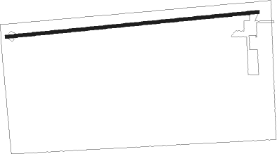
Runway info
| Runway 8 / 26 | ||
| length | 741m (2431ft) | |
| bearing | 89° / 269° | |
| width | 9m (30ft) | |
| surface | asphalt | |
Nearby beacons
| code | identifier | dist | bearing | frequency |
|---|---|---|---|---|
| PK | HERBB (OLATHE) NDB | 17 | 265° | 420 |
| ANX | NAPOLEON VORTAC | 21.9 | 38° | 114 |
| BUM | BUTLER VORTAC | 31.1 | 193° | 115.90 |
| MCI | KANSAS CITY VORTAC | 34.5 | 324° | 113.25 |
| JZ | NEWBN (LAWRENCE) NDB | 37.2 | 279° | 338 |
| RN | HUGGY (KANSAS CITY) NDB | 38.2 | 317° | 416 |
| SZL | WHITEMAN (KNOB NOSTER) TACAN | 38.6 | 93° | 109.80 |
| OWI | OTTAWA NDB | 43.7 | 255° | 251 |
| BQS | BRAYMER VOR/DME | 55.9 | 31° | 115.35 |
| ST | TARIO (ST JOSEPH) NDB | 59 | 329° | 260 |
Disclaimer
The information on this website is not for real aviation. Use this data with the X-Plane flight simulator only! Data taken with kind consent from X-Plane 12 source code and data files. Content is subject to change without notice.