Beloit
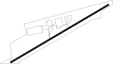
Airport details
| Country | United States of America |
| State | Wisconsin |
| Region | K5 |
| Airspace | Chicago Ctr |
| Municipality | Town of Turtle |
| Elevation | 814ft (248m) |
| Timezone | GMT -6 |
| Coordinates | 42.49778, -88.96761 |
| Magnetic var | |
| Type | land |
| Available since | X-Plane v10.40 |
| ICAO code | 44C |
| IATA code | n/a |
| FAA code | 44C |
Communication
| Beloit CTAF/UNICOM | 122.700 |
| Beloit ROCKFORD Approach/Departure | 121.000 |
Nearby Points of Interest:
Dougan Round Barn
-First Congregational Church
-Beloit Water Tower
-City of Beloit Waterworks and Pump Station
-Lathrop-Munn Cobblestone House
-Shopiere Congregational Church
-Chicago & North Western Railway Stone Arch Bridge
-H.D. Jameson House
-John Smith House
-Richardson-Brinkman Cobblestone House
-Macktown Historic District
-Samuel S. Jones Cobblestone House
-Erastus Dean Farmstead
-John H. Jones House
-Court Street Methodist Church
-Jefferson Avenue Historic District
-James B. Crosby House
-Kenneth and Phyllis Laurent House
-Robert Weber Round Barn
-Lysander Jacoby House
-Charles Lundberg House
-Amos Catlin Spafford House
-Illinois National Guard Armory
-Peacock Brewery
-Rockford Elk's Lodge No. 64
Nearby beacons
| code | identifier | dist | bearing | frequency |
|---|---|---|---|---|
| JVL | JANESVILLE VOR/DME | 7 | 294° | 114.30 |
| RFD | DME | 19.3 | 220° | 110.80 |
| BUU | (BURLINGTON) DME | 31.6 | 74° | 114.50 |
| PLL | POLO VOR/DME | 40.4 | 226° | 111.20 |
| RYV | ROCK RIVER (WATERTOWN) NDB | 41.9 | 20° | 371 |
| MSN | MADISON VORTAC | 42.1 | 330° | 108.60 |
| DPA | DUPAGE (CHICAGO) VOR/DME | 45.6 | 135° | 108.40 |
| BAE | BADGER (MILWAUKEE) VOR/DME | 47.8 | 48° | 116.40 |
| LJT | (MILWAUKEE) DME | 55 | 57° | 115.65 |
| UNU | JUNEAU NDB | 57.1 | 16° | 344 |
| JOT | JOLIET VOR/DME | 64 | 146° | 112.30 |
| BJB | WEST BEND VOR | 66.7 | 42° | 109.80 |
Disclaimer
The information on this website is not for real aviation. Use this data with the X-Plane flight simulator only! Data taken with kind consent from X-Plane 12 source code and data files. Content is subject to change without notice.