Pleasant Valley - Sky Acres
Airport details
| Country | United States of America |
| State | New York |
| Region | K6 |
| Airspace | Boston Ctr |
| Municipality | Town of Union Vale |
| Elevation | 700ft (213m) |
| Timezone | GMT -5 |
| Coordinates | 41.70742, -73.73803 |
| Magnetic var | |
| Type | land |
| Available since | X-Plane v10.40 |
| ICAO code | 44N |
| IATA code | n/a |
| FAA code | n/a |
Communication
| SKY ACRES CTAF/UNICOM | 122.800 |
| SKY ACRES NEW YORK Approach/Departure | 132.750 |
Nearby Points of Interest:
Innisfree Garden
-LaGrange District Schoolhouse
-Newcomb–Brown Estate
-Lynfeld
-Beekman Meeting House and Friends' Cemetery
-Thorne Memorial School
-Bloomvale Historic District
-Murphy Grist Mill
-Elias Titus House
-Storm-Adriance-Brinckerhoff House
-Vassar College Observatory
-Main Building
-Rombout House
-Tabor-Wing House
-Creek Meeting House and Friends' Cemetery
-Clinton Corners Friends Church
-Top Cottage
-Bykenhulle
-Mader House
-Glebe House
-Joseph Horton House
-Poughkeepsie Meeting House
-Freer House
-O. H. Booth Hose Company
-Ethal House
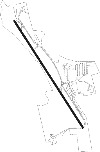
Runway info
| Runway 17 / 35 | ||
| length | 1169m (3835ft) | |
| bearing | 144° / 324° | |
| width | 18m (60ft) | |
| surface | asphalt | |
Nearby beacons
| code | identifier | dist | bearing | frequency |
|---|---|---|---|---|
| IGN | KINGSTON VOR/DME | 4.5 | 244° | 117.60 |
| PWL | PAWLING (POUGHKEEPSIE) VOR/DME | 7.2 | 66° | 114.30 |
| SKU | STANWYCK (NEWBURGH) NDB | 17.4 | 240° | 261 |
| SW | NEELY (NEWBURGH) NDB | 25.7 | 246° | 335 |
| CMK | CARMEL VOR/DME | 26.6 | 160° | 116.60 |
| PFH | PHILMONT (HUDSON) NDB | 32.7 | 2° | 272 |
| HUO | HUGUENOT VOR/DME | 42.3 | 251° | 116.10 |
| BDR | BRIDGEPORT VOR/DME | 42.9 | 132° | 108.80 |
| HVN | HAVEN DME | 46.7 | 118° | 109.80 |
| CTR | CHESTER VOR/DME | 49.6 | 53° | 115.10 |
| SAX | SPARTA VORTAC | 52.6 | 231° | 115.70 |
| TEB | TETERBORO VOR/DME | 53.6 | 201° | 108.40 |
| LGA | LA GUARDIA (NEW YORK) VOR/DME | 55.7 | 188° | 113.10 |
| MM | MOREE (MORRISTOWN) NDB | 56.5 | 216° | 392 |
| FR | FRIKK (FARMINGDALE) NDB | 57 | 165° | 407 |
| TE | TORBY (TETERBORO) NDB | 57 | 204° | 214 |
| DPK | DEER PARK VOR/DME | 58.3 | 155° | 117.70 |
| CCC | CALVERTON VOR/DME | 63 | 130° | 117.20 |
| CAT | CHATHAM NDB | 65.9 | 216° | 254 |
Instrument approach procedures
| runway | airway (heading) | route (dist, bearing) |
|---|---|---|
| RW17 | JSSIE (146°) | JSSIE 3000ft |
| RW17 | STUBY (237°) | STUBY GELAW (11mi, 280°) 4000ft JSSIE (9mi, 249°) 3000ft |
| RW17 | WEETS (108°) | WEETS AROME (5mi, 86°) 4000ft JSSIE (10mi, 87°) 3000ft |
| RNAV | JSSIE 3000ft KMBER (6mi, 145°) 2300ft 44N (5mi, 146°) 686ft (4680mi, 119°) 1098ft JSSIE (4688mi, 300°) 3000ft JSSIE (turn) | |
| RW35 | LOVES (304°) | LOVES REDME (6mi, 269°) 3000ft |
| RW35 | NOBBI (341°) | NOBBI REDME (7mi, 9°) 3000ft |
| RW35 | VALRE (28°) | VALRE HIBBY (3mi, 75°) 4000ft REDME (10mi, 67°) 3000ft |
| RNAV | REDME 3000ft HAGWE (6mi, 326°) 2400ft 44N (5mi, 326°) 737ft COVDA (3mi, 326°) JSSIE (9mi, 325°) 3000ft JSSIE (turn) |
Disclaimer
The information on this website is not for real aviation. Use this data with the X-Plane flight simulator only! Data taken with kind consent from X-Plane 12 source code and data files. Content is subject to change without notice.