Cochran
Airport details
| Country | United States of America |
| State | Georgia |
| Region | K7 |
| Airspace | Atlanta Ctr |
| Municipality | Bleckley County |
| Elevation | 333ft (101m) |
| Timezone | GMT -5 |
| Coordinates | 32.40013, -83.27781 |
| Magnetic var | |
| Type | land |
| Available since | X-Plane v10.40 |
| ICAO code | 48A |
| IATA code | n/a |
| FAA code | n/a |
Communication
| Cochran CTAF/UNICOM | 122.800 |
| Cochran ATLANTA Approach/Departure | 119.600 |
| Cochran ATLANTA Approach/Departure | 124.200 |
Nearby Points of Interest:
Hillcrest (Cochran, Georgia)
-Cochran Municipal Building and School
-Bleckley County Courthouse
-St. Thomas African Methodist Episcopal Church
-Hawkinsville Opera House
-Pulaski County Courthouse
-Merritt-Ragan House
-Taylor Hall
-William Pitt Eastman House
-Dodge County Courthouse
-Peabody School
-Twiggs County Courthouse
-Stubbs Park–Stonewall Street Historic District
-Carnegie Library
-Dublin Commercial Historic District
-Warner Robins Depot
-Myrick's Mill
-Wilcox County Courthouse
-Telfair Center for the Arts
-Max and Emma Sue McRae House
-Telfair County Courthouse and Jail
-Elam-Camp House
-Wheeler County Courthouse
-Luther Williams Field
-Bowden Golf Course
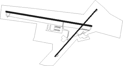
Runway info
Runway 11 / 29  | ||
| length | 1342m (4403ft) | |
| bearing | 102° / 282° | |
| width | 23m (75ft) | |
| surface | asphalt | |
| blast zone | 34m (112ft) / 30m (98ft) | |
| Runway 5 / 23 | ||
| length | 977m (3205ft) | |
| bearing | 51° / 231° | |
| width | 15m (50ft) | |
| surface | asphalt | |
Nearby beacons
| code | identifier | dist | bearing | frequency |
|---|---|---|---|---|
| DB | CREKE (DUBLIN) NDB | 14.4 | 73° | 251 |
| VNA | VIENNA VORTAC | 15.8 | 230° | 116.50 |
| EZM | EASTMAN NDB | 17.3 | 155° | 366 |
| WRB | ROBINS (WARNER ROBINS) TACAN | 21.4 | 308° | 135.30 |
| DBN | DUBLIN VORTAC | 24.7 | 70° | 113.10 |
| MCN | MACON VORTAC | 25.5 | 308° | 114.20 |
| MQW | MC RAE NDB | 27.1 | 128° | 280 |
| IZS | MONTEZUMA NDB | 37 | 267° | 426 |
| OHY | CONEY (CORDELE) NDB | 38.2 | 235° | 400 |
| LKG | LINDBERGH (AMERICUS) NDB | 44.2 | 255° | 242 |
| AZE | HAZLEHURST NDB | 44.7 | 130° | 414 |
| EEX | EMANUEL COUNTY (SWAINSBORO) NDB | 44.7 | 72° | 309 |
| UMB | CULVR (MILLEDGEVILLE) NDB | 45.5 | 9° | 380 |
| SUR | FITZGERALD NDB | 47.2 | 181° | 362 |
| ACJ | SOUTHER (AMERICUS) NDB | 49.3 | 252° | 242 |
| UQN | ONYUN (VIDALIA) NDB | 50.8 | 100° | 372 |
| OP | YATES (THOMASTON) NDB | 55.5 | 300° | 339 |
| IFM | TIFT MYERS (TIFTON) VOR | 59.3 | 192° | 112.50 |
| BHC | BAXLEY NDB | 61.2 | 128° | 376 |
| OWC | COFFEE COUNTY (DOUGLAS) NDB | 62.4 | 160° | 390 |
| AMG | ALMA VORTAC | 65 | 138° | 115.10 |
Instrument approach procedures
| runway | airway (heading) | route (dist, bearing) |
|---|---|---|
| RW11 | COSSA (102°) | COSSA 2100ft |
| RW11 | MCN (128°) | MCN COSSA (16mi, 149°) 2100ft |
| RW11 | VNA (50°) | VNA HIGEN (9mi, 346°) 2100ft COSSA (6mi, 16°) 2100ft |
| RNAV | COSSA 2100ft WEKED (7mi, 102°) 1900ft JATAV (2mi, 102°) 1160ft 48A (3mi, 103°) 431ft (5065mi, 111°) 900ft VNA (5075mi, 291°) 2100ft VNA (turn) | |
| RW29 | DBN (250°) | DBN RELCY (13mi, 239°) 2100ft POSEC (5mi, 197°) 2100ft |
| RW29 | POSEC (282°) | POSEC 2100ft |
| RW29 | VNA (50°) | VNA HUMDA (21mi, 81°) 2100ft POSEC (5mi, 17°) 2100ft |
| RNAV | POSEC 2100ft TIZRA (6mi, 282°) 1900ft INXUF (3mi, 282°) 940ft 48A (2mi, 281°) 374ft (5065mi, 111°) 659ft ELTEW (5068mi, 291°) VNA (14mi, 217°) 2100ft VNA (turn) |
Disclaimer
The information on this website is not for real aviation. Use this data with the X-Plane flight simulator only! Data taken with kind consent from X-Plane 12 source code and data files. Content is subject to change without notice.