Young - Pleasant Valley Airstrip
Airport details
| Country | United States of America |
| State | Arizona |
| Region | |
| Airspace | Albuquerque Ctr |
| Municipality | Gila County |
| Elevation | 5687ft (1733m) |
| Timezone | GMT -7 |
| Coordinates | 34.15691, -110.94204 |
| Magnetic var | |
| Type | land |
| Available since | X-Plane v10.40 |
| ICAO code | 49E |
| IATA code | n/a |
| FAA code | n/a |
Communication
| Pleasant Valley Airstrip AWOS | 119.325 |
| Pleasant Valley Airstrip AWOS | 119.075 |
Nearby Points of Interest:
Pleasant Valley Ranger Station
-Sears-Kay Ruin
-Strawberry Schoolhouse
Runway info
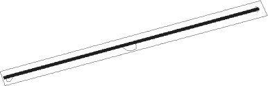
| Runway 06 / 24 | ||
| length | 1205m (3953ft) | |
| bearing | 81° / 261° | |
| width | 11m (35ft) | |
| surface | gravel | |
Nearby beacons
| code | identifier | dist | bearing | frequency |
|---|---|---|---|---|
| PAN | DME | 20.3 | 284° | 116.35 |
| INW | WINSLOW VORTAC | 54.8 | 9° | 112.60 |
| IWA | WILLIE (PHOENIX) VORTAC | 62.3 | 220° | 113.30 |
| FLG | FLAGSTAFF VOR/DME | 69.6 | 324° | 113.85 |
Disclaimer
The information on this website is not for real aviation. Use this data with the X-Plane flight simulator only! Data taken with kind consent from X-Plane 12 source code and data files. Content is subject to change without notice.