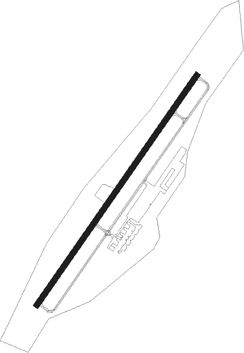
Fort Payne - Isbell Fld
Airport details
| Country | United States of America |
| State | Alabama |
| Region | K7 |
| Airspace | Atlanta Ctr |
| Municipality | Fort Payne |
| Elevation | 875ft (267m) |
| Timezone | GMT -6 |
| Coordinates | 34.47369, -85.72139 |
| Magnetic var | |
| Type | land |
| Available since | X-Plane v10.40 |
| ICAO code | 4A9 |
| IATA code | n/a |
| FAA code | n/a |
Communication
| Isbell Fld AWOS 3 | 119.025 |
| Isbell Fld CTAF/UNICOM | 122.800 |
Nearby Points of Interest:
W. B. Davis Hosiery Mill
-Cherokee Plantation (Alabama)
-Vance C. Larmore House
-Winston Place
-Dr. J.A. Gorman House
-Dancy-Polk House
-College Hill Historic District
-Public Square Historic District
-Brown-Proctor House
-Scottsboro Memphis and Charleston Railroad Depot
-Fort Harker
-General William Rosecrans Headquarters
-Walker County Courthouse
-Marsh-Warthen House
-Dade County Courthouse
-Albertville Depot
-Thomas A. Snellgrove Homestead
-United States Post Office
-Edward Fenns Whitman House
-Skyline Commissary
-Bridgeport Historic District
-Henry-Jordan House
-Albert G. Henry, Jr., House
-Downtown Guntersville Historic District
-Guntersville Post Office
Nearby beacons
| code | identifier | dist | bearing | frequency |
|---|---|---|---|---|
| GAD | GADSDEN VOR/DME | 34.8 | 216° | 112.30 |
| RMG | ROME VORTAC | 35.2 | 117° | 115.40 |
| GQO | CHOO CHOO (CHATTANOOGA) VORTAC | 40.5 | 49° | 115.80 |
| RQZ | ROCKET (HUNTSVILLE) VORTAC | 49 | 290° | 112.20 |
| CQN | DAISY (N.CHATTANOOGA) NDB | 50 | 39° | 341 |
| TDG | DME | 56.2 | 200° | 108.80 |
| AN | BOGGA (ANNISTON) NDB | 57.3 | 193° | 211 |
| GPQ | CARROLLTON NDB | 61.9 | 147° | 278 |
Instrument approach procedures
| runway | airway (heading) | route (dist, bearing) |
|---|---|---|
| RW04 | CIVMA (64°) | CIVMA 4000ft COHHE (5mi, 124°) 4000ft |
| RW04 | COHHE (45°) | COHHE 4000ft |
| RW04 | ONANY (23°) | ONANY 4000ft COHHE (5mi, 304°) 4000ft |
| RNAV | COHHE 4000ft APEKE (7mi, 45°) 3000ft WELSI (4mi, 45°) 1760ft 4A9 (3mi, 45°) 916ft (5193mi, 112°) 1234ft COVID (5185mi, 292°) 4000ft COVID (turn) | |
| RW22-Y | BROOS (191°) | BROOS 4000ft RHODA (5mi, 116°) 4000ft |
| RW22-Y | HUTGO (238°) | HUTGO 4000ft RHODA (5mi, 296°) 4000ft |
| RW22-Y | RHODA (216°) | RHODA 4000ft |
| RNAV | RHODA 4000ft AMUZE (6mi, 215°) 3000ft ISBAW (5mi, 215°) 1084ft (5193mi, 112°) 1280ft RHODA (5187mi, 292°) 4000ft RHODA (turn) | |
| RW22-Z | COVID (225°) | COVID 4000ft |
| RW22-Z | HORAM (203°) | HORAM 4000ft COVID (5mi, 124°) 4000ft |
| RW22-Z | WAMIR (245°) | WAMIR 4000ft COVID (5mi, 304°) 4000ft |
| RNAV | COVID 4000ft JILED (6mi, 225°) 3100ft 4A9 (7mi, 225°) 913ft (5193mi, 112°) 1214ft COHHE (5201mi, 292°) 4000ft COHHE (turn) |
Disclaimer
The information on this website is not for real aviation. Use this data with the X-Plane flight simulator only! Data taken with kind consent from X-Plane 12 source code and data files. Content is subject to change without notice.