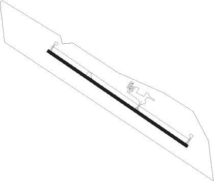
Albia - Albia Muni
Airport details
| Country | United States of America |
| State | Iowa |
| Region | K3 |
| Airspace | Chicago Ctr |
| Municipality | Monroe County |
| Elevation | 959ft (292m) |
| Timezone | GMT -6 |
| Coordinates | 40.99628, -92.76569 |
| Magnetic var | |
| Type | land |
| Available since | X-Plane v10.30 |
| ICAO code | 4C8 |
| IATA code | n/a |
| FAA code | n/a |
Communication
| Albia Muni CTAF/UNICOM | 122.800 |
Nearby Points of Interest:
Elbert-Bates House
-Monroe County Courthouse
-Arvine and Elizabeth W. White House
-Evan F. Ellis Farmhouse
-Eveland Bridge
-Hammond Bridge
-Jefferson Street Viaduct
-Ottumwa Young Women's Christian Association
-First National Bank
-Ottumwa City Hall
-Benson Building
-Wapello County Courthouse
-J.W. Garner Building
-Benson Block
-Greater Second Street Historic District
-Jay Funeral Home
-Ottumwa Public Library
-Court Hill Historic District
-Foster/Bell House
-Fifth Street Bluff Historic District
-Ottumwa Cemetery
-Courthouse Square Historic District
-Appanoose County Courthouse
-Vogel Place Historic District
-Porter Hall
Nearby beacons
| code | identifier | dist | bearing | frequency |
|---|---|---|---|---|
| OTM | OTTUMWA VOR/DME | 20 | 86° | 111.60 |
| BEX | BLOOMFIELD NDB | 21.4 | 127° | 269 |
| PEA | PELLA NDB | 25.8 | 336° | 257 |
| DSM | DES MOINES VORTAC | 47.8 | 297° | 117.50 |
| TNU | NEWTON VOR/DME | 49.7 | 336° | 112.50 |
| IRK | KIRKSVILLE VORTAC | 52.3 | 169° | 114.60 |
| CID | CEDAR RAPIDS VOR/DME | 69.3 | 48° | 114.10 |
Instrument approach procedures
| runway | airway (heading) | route (dist, bearing) |
|---|---|---|
| RW13 | WIVEV (121°) | WIVEV 6000ft WIVEV (turn) 3000ft |
| RNAV | WIVEV 3000ft CEPUX (6mi, 121°) 2600ft 4C8 (5mi, 121°) 988ft (5531mi, 114°) 1268ft KIGIQ (5522mi, 294°) 3000ft KIGIQ (turn) | |
| RW31 | KIGIQ (301°) | KIGIQ 3000ft |
| RNAV | KIGIQ 3000ft UJUSU (6mi, 301°) 2600ft ZILTU (3mi, 301°) 1500ft 4C8 (2mi, 301°) 1003ft (5531mi, 114°) 1267ft WIVEV (5539mi, 294°) 3000ft WIVEV (turn) |
Disclaimer
The information on this website is not for real aviation. Use this data with the X-Plane flight simulator only! Data taken with kind consent from X-Plane 12 source code and data files. Content is subject to change without notice.
