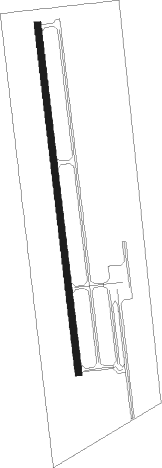
Carthage - Panola Co Sharpe Fld
Airport details
| Country | United States of America |
| State | Texas |
| Region | K4 |
| Airspace | Ft Worth Ctr |
| Municipality | Panola County |
| Elevation | 248ft (76m) |
| Timezone | GMT -6 |
| Coordinates | 32.17608, -94.29881 |
| Magnetic var | |
| Type | land |
| Available since | X-Plane v10.40 |
| ICAO code | 4F2 |
| IATA code | n/a |
| FAA code | n/a |
Communication
| Panola Co Sharpe Fld CTAF/UNICOM | 122.800 |
| Panola Co Sharpe Fld SHREVEPORT Approach/Departure | 119.900 |
| Panola Co Sharpe Fld SHREVEPORT Approach/Departure | 121.400 |
Nearby Points of Interest:
Keachi Baptist Church
-Liberty Lodge No. 123, F&AM
-Keachi United Methodist Church
-Keachi Presbyterian Church
-James Turner House
-Sam B. Hall, Jr. Federal Building and United States Courthouse
-Old Harrison County Courthouse
-Arnot House
-Fry-Barry House
-Hagerty House
-Ginocchio Historic District
-Henderson Commercial Historic District
-Grand Cane United Methodist Church
-Mimosa Hall
-DeSoto Parish Courthouse
-Shreveport Fire Station No. 8
-Huey P. Long House
-South Highlands Fire Station
-Antioch Baptist Church
-Shreveport Municipal Memorial Auditorium
-Masonic Temple
-St. Mark's Episcopal Church
Nearby beacons
| code | identifier | dist | bearing | frequency |
|---|---|---|---|---|
| RPF | CARTHAGE NDB | 0.2 | 30° | 332 |
| CZJ | AMASON (CENTER) NDB | 21.8 | 157° | 341 |
| GGG | GREGG CO. (LONGVIEW) VORTAC | 27.2 | 298° | 112.90 |
| GG | VEELS (LONGVIEW) NDB | 30.3 | 299° | 410 |
| BAD | BARKSDALE (BOSSIER CITY) TACAN | 37.5 | 63° | 115.80 |
| EMG | ELM GROVE VORTAC | 38.1 | 72° | 111.20 |
| EIC | BELCHER (SHREVEPORT) VORTAC | 43.4 | 39° | 117.40 |
| OC | NADOS (NACOGDOCHES) NDB | 46.7 | 211° | 253 |
| ABG | AMBASSADOR (BIG SANDY) NDB | 48 | 297° | 404 |
| ATA | ATLANTA NDB | 56 | 7° | 347 |
| LF | FLUFY (LUFKIN) NDB | 63.4 | 209° | 350 |
Instrument approach procedures
| runway | airway (heading) | route (dist, bearing) |
|---|---|---|
| RW17 | TUYPO (177°) | TUYPO 2000ft |
| RNAV | TUYPO 2000ft POYLI (9mi, 177°) 2000ft 4F2 (6mi, 177°) 284ft JIPRI (15mi, 177°) 3800ft JIPRI (turn) | |
| RW35 | EXITE (295°) | EXITE JIPRI (18mi, 257°) 3800ft |
| RW35 | GGG (118°) | GGG WENED (35mi, 143°) 3800ft JIPRI (5mi, 88°) 3800ft |
| RW35 | JIPRI (357°) | JIPRI 3800ft |
| RNAV | JIPRI 3800ft PUCIN (9mi, 357°) 2000ft 4F2 (6mi, 357°) 288ft (5624mi, 109°) 648ft TUYPO (5624mi, 289°) 2000ft TUYPO (turn) |
Disclaimer
The information on this website is not for real aviation. Use this data with the X-Plane flight simulator only! Data taken with kind consent from X-Plane 12 source code and data files. Content is subject to change without notice.
