Hornell - Hornell Muni
Airport details
| Country | United States of America |
| State | New York |
| Region | K6 |
| Airspace | Cleveland Ctr |
| Municipality | City of Hornell |
| Elevation | 1220ft (372m) |
| Timezone | GMT -5 |
| Coordinates | 42.38214, -77.68211 |
| Magnetic var | |
| Type | land |
| Available since | X-Plane v10.40 |
| ICAO code | 4G6 |
| IATA code | n/a |
| FAA code | HTF |
Communication
| Hornell Muni AWOS 3 | 118.475 |
| Hornell Muni CTAF/UNICOM | 122.700 |
Nearby Points of Interest:
Hornell Armory
-United States Post Office
-Hornell Public Library
-Allen Steinheim Museum
-Alfred Village Historic District
-Alumni Hall
-Fireman's Hall
-Pioneer Farm
-Dansville Library
-Larrowe House
-William Hartman Farmstead
-Engleside
-Elias H. Geiger House
-Presbyterian Church of Atlanta
-Moses Van Campen House
-Old Allegany County Courthouse
-Erie Freighthouse Historic District
-Cobblestone House
-William Shepherd House
-Davenport Library
-M. J. Ward Feed Mill Complex
-Reuben Robie House
-George W. Hallock House
-Haverling Farm House
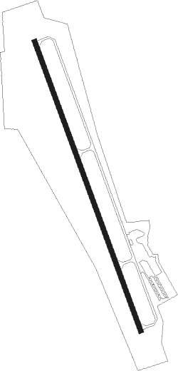
Runway info
| Runway 18 / 36 | ||
| length | 1526m (5007ft) | |
| bearing | 159° / 339° | |
| width | 23m (75ft) | |
| surface | asphalt | |
| displ threshold | 152m (499ft) / 0m (0ft) | |
Nearby beacons
| code | identifier | dist | bearing | frequency |
|---|---|---|---|---|
| ELZ | DME | 22.5 | 227° | 111.40 |
| GEE | GENESEO VOR/DME | 27.2 | 354° | 108.20 |
| PYA | PENN YAN NDB | 31.8 | 67° | 260 |
| ULW | ELMIRA VOR/DME | 33.9 | 114° | 109.65 |
| ALP | ALPINE (ELMIRA) NDB | 41.6 | 99° | 245 |
| SFK | STONYFORK VOR/DME | 42.8 | 159° | 108.60 |
| ROC | ROCHESTER VOR/DME | 44.1 | 1° | 110 |
| BUF | BUFFALO VOR/DME | 53.7 | 300° | 116.40 |
| SLT | SLATE RUN VORTAC | 53.7 | 198° | 113.90 |
| BFD | DME | 55 | 238° | 116.60 |
| BU | KLUMP (BUFFALO) NDB | 56.6 | 303° | 231 |
Disclaimer
The information on this website is not for real aviation. Use this data with the X-Plane flight simulator only! Data taken with kind consent from X-Plane 12 source code and data files. Content is subject to change without notice.