St Marys - St. Mary's
Airport details
| Country | United States of America |
| State | Georgia |
| Region | K7 |
| Airspace | Jacksonville Ctr |
| Municipality | St. Marys |
| Elevation | 22ft (7m) |
| Timezone | GMT -5 |
| Coordinates | 30.75325, -81.55828 |
| Magnetic var | |
| Type | land |
| Available since | X-Plane v10.40 |
| ICAO code | 4J6 |
| IATA code | n/a |
| FAA code | n/a |
Communication
| St. Mary's CTAF/UNICOM | 122.800 |
| St. Mary's JACKSONVILLE Approach/Departure | 127.000 |
Nearby Points of Interest:
Orange Hall
-St. Marys Historic District
-Fairbanks House
-Fernandina Beach Historic District
-Bailey House
-Tabby House
-Merrick-Simmons House
-John Denham Palmer House
-Mount Olive Missionary Baptist Church
-Hippard House
-Ervin's Rest
-Old Camden County Courthouse
-Woodbine Historic District
-Rockefeller Cottage
-jekyll island club resort
-Faith Chapel
-Kingsley Plantation
-Ribault Inn Club
-Napoleon Bonaparte Broward House
-Horton House Historic Site
-St. Johns River Light
-Lewis Mausoleum
-St. Johns Light
-Charlton County Courthouse
-William Mizell, Sr., House
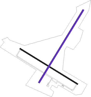
Runway info
| Runway 4 / 22 | ||
| length | 1535m (5036ft) | |
| bearing | 40° / 220° | |
| width | 30m (98ft) | |
| surface | asphalt | |
| displ threshold | 233m (764ft) / 303m (994ft) | |
Runway 13 / 31  | ||
| length | 1218m (3996ft) | |
| bearing | 122° / 302° | |
| width | 23m (75ft) | |
| surface | asphalt | |
| displ threshold | 213m (699ft) / 213m (699ft) | |
| blast zone | 168m (551ft) / 102m (335ft) | |
Nearby beacons
| code | identifier | dist | bearing | frequency |
|---|---|---|---|---|
| SSI | BRUNSWICK (ST SIMONS I) VORTAC | 18.7 | 21° | 109.80 |
| JA | DINNS (JACKSONVILLE) NDB | 21.3 | 220° | 344 |
| NRB | MAYPORT TACAN | 22.9 | 160° | 111.40 |
| CRG | CRAIG (JACKSONVILLE) VORTAC | 25 | 173° | 114.50 |
| NIP | JACKSONVILLE TACAN | 31.7 | 193° | 108.20 |
| NZC | CECIL TACAN | 35.8 | 210° | 114.10 |
| RYD | REYNOLDS (GREEN COVE SPRINGS) NDB | 47.5 | 187° | 338 |
| SGJ | SAINT AUGUSTINE VOR/DME | 49.2 | 164° | 109.40 |
| TAY | TAYLOR VORTAC | 53.5 | 256° | 112.90 |
| AY | WIKET (WAYCROSS) NDB | 55.2 | 304° | 219 |
| AYS | WAYCROSS VORTAC | 60 | 297° | 110.20 |
| AMG | ALMA VORTAC | 67.7 | 310° | 115.10 |
| BHC | BAXLEY NDB | 71.6 | 319° | 376 |
Disclaimer
The information on this website is not for real aviation. Use this data with the X-Plane flight simulator only! Data taken with kind consent from X-Plane 12 source code and data files. Content is subject to change without notice.