Soperton - Treutlen County
Airport details
| Country | United States of America |
| State | Georgia |
| Region | K7 |
| Airspace | Jacksonville Ctr |
| Municipality | Treutlen County |
| Elevation | 345ft (105m) |
| Timezone | GMT -5 |
| Coordinates | 32.38739, -82.56339 |
| Magnetic var | |
| Type | land |
| Available since | X-Plane v10.40 |
| ICAO code | 4J8 |
| IATA code | n/a |
| FAA code | n/a |
Communication
| Treutlen County CTAF | 122.900 |
Nearby Points of Interest:
Treutlen County Courthouse
-Willie T. McArthur Farm
-Vidalia Commercial Historic District
-Citizens Bank of Vidalia
-Leader–Rosansky House
-Montgomery County Courthouse
-Peterson-Wilbanks House
-Crawford W. Brazell House
-McLemore-Sharpe Farmstead
-Glenwood High School
-Robert and Missouri Garbutt House
-Swainsboro Light and Water Plant
-James Coleman House
-First Methodist Episcopal Church
-Wheeler County Courthouse
-Carnegie Library
-Dublin Commercial Historic District
-Stubbs Park–Stonewall Street Historic District
-Albert Neal Durden House
-Johnson County Courthouse
-John Rountree Log House
-Woodland
-Twin City Historic District
-Davis-Proctor House
-Josiah Davis House
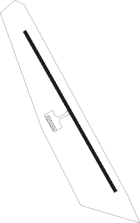
Runway info
| Runway 16 / 34 | ||
| length | 915m (3002ft) | |
| bearing | 151° / 331° | |
| width | 15m (50ft) | |
| surface | asphalt | |
Nearby beacons
| code | identifier | dist | bearing | frequency |
|---|---|---|---|---|
| UQN | ONYUN (VIDALIA) NDB | 16.7 | 122° | 372 |
| DBN | DUBLIN VORTAC | 17.1 | 303° | 113.10 |
| EEX | EMANUEL COUNTY (SWAINSBORO) NDB | 17.6 | 22° | 309 |
| DB | CREKE (DUBLIN) NDB | 23.4 | 282° | 251 |
| MQW | MC RAE NDB | 23.8 | 228° | 280 |
| AZE | HAZLEHURST NDB | 30.7 | 189° | 414 |
| EZM | EASTMAN NDB | 33.6 | 247° | 366 |
| BHC | BAXLEY NDB | 41.5 | 166° | 376 |
| BZ | BULLO (STATESBORO) NDB | 45.6 | 88° | 407 |
| VNA | VIENNA VORTAC | 48.5 | 259° | 116.50 |
| AMG | ALMA VORTAC | 51.1 | 176° | 115.10 |
| JYL | SYLVANIA NDB | 51.5 | 75° | 245 |
| UMB | CULVR (MILLEDGEVILLE) NDB | 54.9 | 322° | 380 |
| SUR | FITZGERALD NDB | 59.4 | 223° | 362 |
| OWC | COFFEE COUNTY (DOUGLAS) NDB | 61.8 | 200° | 390 |
| AG | BUSHE (AUGUSTA) NDB | 62.3 | 34° | 233 |
| IFM | TIFT MYERS (TIFTON) VOR | 74.4 | 224° | 112.50 |
Disclaimer
The information on this website is not for real aviation. Use this data with the X-Plane flight simulator only! Data taken with kind consent from X-Plane 12 source code and data files. Content is subject to change without notice.