Clinton - Clinton Muni
Airport details
| Country | United States of America |
| State | Arkansas |
| Region | K4 |
| Airspace | Memphis Ctr |
| Municipality | Clinton |
| Elevation | 514ft (157m) |
| Timezone | GMT -6 |
| Coordinates | 35.59778, -92.45167 |
| Magnetic var | |
| Type | land |
| Available since | X-Plane v10.40 |
| ICAO code | 4M4 |
| IATA code | n/a |
| FAA code | CCA |
Communication
| Clinton Muni AWOS-3 | 118.725 |
| Clinton Muni CTAF | 122.700 |
Nearby Points of Interest:
Clinton Commercial Historic District
-Van Buren County Courthouse
-Walter Patterson Filling Station
-Joclin-Bradley-Bowling House
-Walter Patterson House
-Middle Fork of the Little Red River Bridge
-Art Scanlan House
-Collums-Baker House
-Van Buren County Road 2E Bridge
-Melvin Chrisco House
-Damascus CCC Camp, Co. No. 3781 Historic District
-Brewer School
-Damascus Gymnasium
-Carl and Esther Lee House
-Lee Service Station
-Turkey Creek School
-Earl and Oza Crownover-Brown House
-Missouri and North Arkansas Depot-Leslie
-Columbus Hatchett House
-Farmers Bank Building
-Leslie-Rolen House
-Dr. Clay House
-American Legion Post No. 131
-Leslie Commercial Historic District
-Dr. J.O. Cotton House
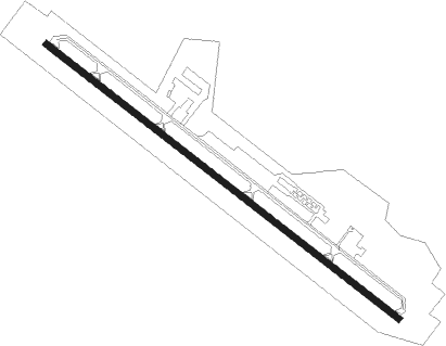
Runway info
| Runway 13 / 31 | ||
| length | 1223m (4012ft) | |
| bearing | 127° / 307° | |
| width | 18m (60ft) | |
| surface | asphalt | |
Nearby beacons
| code | identifier | dist | bearing | frequency |
|---|---|---|---|---|
| BV | ALMND (BATESVILLE) NDB | 32.5 | 81° | 335 |
| RUE | RUSSELLVILLE NDB | 37.5 | 242° | 379 |
| FLP | DME | 42.1 | 359° | 116.05 |
| LRF | JACKSONVILLE TACAN | 43.2 | 157° | 109.20 |
| DS | CERCY (SEARCY) NDB | 44.2 | 125° | 375 |
| LI | LASKY (LITTLE ROCK) NDB | 56.2 | 171° | 353 |
| LIT | LITTLE ROCK VORTAC | 56.8 | 164° | 113.90 |
| HRO | HARRISON VOR/DME | 56.9 | 313° | 112.50 |
Disclaimer
The information on this website is not for real aviation. Use this data with the X-Plane flight simulator only! Data taken with kind consent from X-Plane 12 source code and data files. Content is subject to change without notice.