West Milford - Greenwood Lake
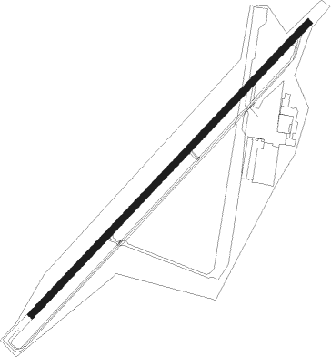
Airport details
| Country | United States of America |
| State | New Jersey |
| Region | K6 |
| Airspace | New York Ctr |
| Municipality | West Milford |
| Elevation | 791ft (241m) |
| Timezone | GMT -5 |
| Coordinates | 41.12839, -74.34653 |
| Magnetic var | |
| Type | land |
| Available since | X-Plane v10.40 |
| ICAO code | 4N1 |
| IATA code | n/a |
| FAA code | n/a |
Communication
| Greenwood Lake CTAF | 122.900 |
| Greenwood Lake NEW YORK Approach/Departure | 127.600 |
Nearby Points of Interest:
The Boulders
-Ringwood Manor
-Sterling Mountain Fire Observation Tower and Observer's Cabin
-Patriots' Path
-Clinton Furnace
-High Breeze Farm
-Sloat House
-Jacob Sloat House
-General John Hathorn Stone House
-Jeremiah Morehouse House
-Van Winkle-Fox House
-Sloat's Dam and Mill Pond
-Warwick Village Historic District
-Brook Chapel
-Van Allen House
-Darlington Schoolhouse
-Demarest House
-Jacobus Demarest House
-Main School
-Hopper-Van Horn House
-Torne Brook Farm
-United States Post Office
-Van Houten-Ackerman House
-Ackerman-Boyd House
-Reaction Motors Rocket Test Facility
Nearby beacons
| code | identifier | dist | bearing | frequency |
|---|---|---|---|---|
| SAX | SPARTA VORTAC | 9.4 | 252° | 115.70 |
| MM | MOREE (MORRISTOWN) NDB | 14.9 | 177° | 392 |
| HUO | HUGUENOT VOR/DME | 20.1 | 319° | 116.10 |
| TEB | TETERBORO VOR/DME | 21.1 | 135° | 108.40 |
| TE | TORBY (TETERBORO) NDB | 21.7 | 147° | 214 |
| SW | NEELY (NEWBURGH) NDB | 22.1 | 18° | 335 |
| CAT | CHATHAM NDB | 23.5 | 192° | 254 |
| STW | STILLWATER VOR/DME | 24.9 | 256° | 109.60 |
| SKU | STANWYCK (NEWBURGH) NDB | 27.5 | 37° | 261 |
| BWZ | BROADWAY (SCHOOLEY'S MT) VOR/DME | 29.2 | 235° | 114.20 |
| LGA | LA GUARDIA (NEW YORK) VOR/DME | 29.9 | 126° | 113.10 |
| CMK | CARMEL VOR/DME | 35.7 | 79° | 116.60 |
| CRI | CANARSIE VOR/DME | 37.1 | 139° | 112.30 |
| SBJ | SOLBERG VOR/DME | 37.3 | 216° | 112.90 |
| JFK | KENNEDY (NEW YORK) VOR/DME | 39.5 | 131° | 115.90 |
| IGN | KINGSTON VOR/DME | 39.9 | 44° | 117.60 |
| FR | FRIKK (FARMINGDALE) NDB | 44.5 | 112° | 407 |
| COL | COLTS NECK VOR/DME | 49.7 | 167° | 115.40 |
| PWL | PAWLING (POUGHKEEPSIE) VOR/DME | 51.1 | 49° | 114.30 |
| RBV | ROBBINSVILLE VORTAC | 56 | 189° | 113.80 |
| ARD | YARDLEY VOR/DME | 58.4 | 213° | 108.20 |
| HNK | HANCOCK VOR/DME | 71 | 314° | 116.80 |
Instrument approach procedures
| runway | airway (heading) | route (dist, bearing) |
|---|---|---|
| RW06 | WAMUV (236°) | WAMUV WEKAS (23mi, 236°) 3000ft WEKAS (turn) 3000ft |
| RNAV | WEKAS 3000ft WAROG (6mi, 55°) 2600ft HESIN (3mi, 56°) 1660ft 4N1 (3mi, 56°) 829ft (4701mi, 119°) 1190ft WAMUV (4694mi, 299°) 3000ft WAMUV (turn) | |
| RW24 | VOLLU (260°) | VOLLU WAMUV (9mi, 293°) 3000ft |
| RW24 | WEKAS (56°) | WEKAS WAMUV (23mi, 56°) 3000ft WAMUV (turn) 3000ft |
| RNAV | WAMUV 3000ft IMAME (6mi, 236°) 2600ft YANUD (2mi, 236°) 1820ft 4N1 (3mi, 236°) 829ft (4701mi, 119°) 1160ft WEKAS (4708mi, 299°) 3000ft WEKAS (turn) |
Disclaimer
The information on this website is not for real aviation. Use this data with the X-Plane flight simulator only! Data taken with kind consent from X-Plane 12 source code and data files. Content is subject to change without notice.