Elmira - Harris Hill
Airport details
| Country | United States of America |
| State | New York |
| Region | |
| Airspace | New York Ctr |
| Municipality | Town of Big Flats |
| Elevation | 1708ft (521m) |
| Timezone | GMT -5 |
| Coordinates | 42.12093, -76.90250 |
| Magnetic var | |
| Type | land |
| Available since | X-Plane v10.40 |
| ICAO code | 4NY8 |
| IATA code | n/a |
| FAA code | 4NY8 |
Communication
Nearby Points of Interest:
John W. Jones House
-Elmira Heights Village Hall
-Elmira College Old Campus
-Near Westside Historic District
-Fire Station No. 4
-Chemung Railway Depot-Horseheads
-Horseheads 1855 Extension Historic District
-Zimmerman House
-Hanover Square Historic District
-Pratt House
-William S. Gerity House
-Buildings at 104–116 West Water St.
-Elmira Civic Historic District
-Chemung County Courthouse Complex
-Chemung Canal Bank Building
-John Brand Jr. House
-Alexander Eustace House
-John Brand Sr. House
-Maple Avenue Historic District
-Quarry Farm
-Market Street Historic District
-Southside Historic District
-World War Memorial Library
-Corning Armory
-United States Post Office
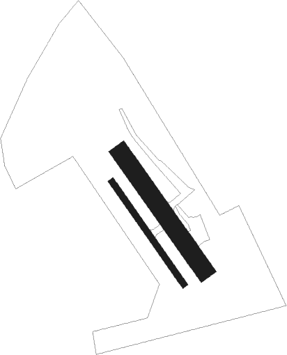
Runway info
Runway 15R / 33L  | ||
| length | 309m (1014ft) | |
| bearing | 142° / 322° | |
| width | 15m (50ft) | |
| surface | asphalt | |
| Runway 15 / 33 | ||
| length | 353m (1158ft) | |
| bearing | 141° / 321° | |
| width | 46m (150ft) | |
| surface | asphalt | |
Nearby beacons
| code | identifier | dist | bearing | frequency |
|---|---|---|---|---|
| ULW | ELMIRA VOR/DME | 5.6 | 258° | 109.65 |
| ALP | ALPINE (ELMIRA) NDB | 9.3 | 50° | 245 |
| ITH | DME | 29.8 | 50° | 111.80 |
| IT | VRNAH (ITHACA) NDB | 30.1 | 60° | 266 |
| PYA | PENN YAN NDB | 32.1 | 344° | 260 |
| CFB | BINGHAMTON VOR/DME | 34.1 | 87° | 112.20 |
| SFK | STONYFORK VOR/DME | 34.4 | 231° | 108.60 |
| FQM | WILLIAMSPORT VOR/DME | 47.3 | 171° | 114.40 |
| GEE | GENESEO VOR/DME | 56.4 | 311° | 108.20 |
| ROC | ROCHESTER VOR/DME | 68.8 | 322° | 110 |
Disclaimer
The information on this website is not for real aviation. Use this data with the X-Plane flight simulator only! Data taken with kind consent from X-Plane 12 source code and data files. Content is subject to change without notice.