Lumberton - I H Bass Jr Memorial
Airport details
| Country | United States of America |
| State | Mississippi |
| Region | K7 |
| Airspace | Houston Oceanic Ctr |
| Municipality | Lumberton |
| Elevation | 310ft (94m) |
| Timezone | GMT -6 |
| Coordinates | 31.01533, -89.48256 |
| Magnetic var | |
| Type | land |
| Available since | X-Plane v10.40 |
| ICAO code | 4R1 |
| IATA code | n/a |
| FAA code | n/a |
Communication
| I H Bass Jr Memorial CTAF | 122.800 |
Nearby Points of Interest:
John Ford Home
-Beverly Drive-In Theater
-Longleaf Trace
-Walthall School
-Eaton Elementary School
-Robert "Bob" Hicks House
-Bogalusa City Hall
-Mahned Bridge
-Bogalusa Post Office
-Old Augusta Historic Site
-George Austin McHenry House
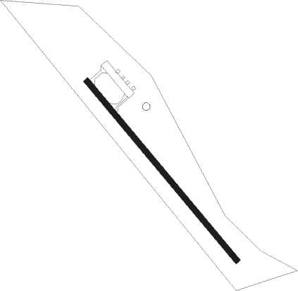
Runway info
| Runway 14 / 32 | ||
| length | 924m (3031ft) | |
| bearing | 140° / 320° | |
| width | 23m (75ft) | |
| surface | asphalt | |
Nearby beacons
| code | identifier | dist | bearing | frequency |
|---|---|---|---|---|
| GVB | BOGALUSA NDB | 21.1 | 251° | 353 |
| LBY | EATON (HATTIESBURG) VORTAC | 25.3 | 20° | 110.60 |
| PCU | PICAYUNE VOR/DME | 30.1 | 209° | 113.95 |
| HS | HANCO (BAY ST LOUIS) NDB | 33.9 | 177° | 221 |
| GP | BAYOU NDB | 35.8 | 149° | 360 |
| GPT | GULFPORT VORTAC | 42.1 | 146° | 109 |
| MCB | MC COMB VORTAC | 43.4 | 290° | 116.70 |
| BIX | KEESLER (BILOXI) TACAN | 46.3 | 138° | 111.80 |
| GCV | GREENE CO. (LEAKESVILLE) VORTAC | 51.5 | 85° | 115.70 |
| HP | ANGER (HAMMOND) NDB | 54.2 | 246° | 212 |
Disclaimer
The information on this website is not for real aviation. Use this data with the X-Plane flight simulator only! Data taken with kind consent from X-Plane 12 source code and data files. Content is subject to change without notice.