Eunice
Airport details
| Country | United States of America |
| State | Louisiana |
| Region | K4 |
| Municipality | Eunice |
| Elevation | 41ft (12m) |
| Timezone | GMT -6 |
| Coordinates | 30.46628, -92.42380 |
| Magnetic var | |
| Type | land |
| Available since | X-Plane v10.40 |
| ICAO code | 4R7 |
| IATA code | n/a |
| FAA code | n/a |
Communication
| Eunice CTAF/UNICOM | 122.800 |
| Eunice LAFAYETTE Approach/Departure | 128.700 |
Nearby Points of Interest:
Le Vieux Presbytere
-Elton United Methodist Church
-Joseph D. Bernard House
-Evangeline Bank and Trust Company
-Alexis LaTour House
-Chretien Point Plantation
-Edward Benjamin Dubuisson House
-Jennings Carnegie Public Library
-Allen Parish Courthouse
-Istre Cemetery Grave Houses
-White's Chapel United Methodist Church
-Brandt House (Lafayette, Louisiana)
-Old Lafayette City Hall
-Freetown-Port Rico Historic District
-Dr. Joseph Angel Villien House
-Bank of Gueydan
-Frithland
-Britt Place
-Texas and Pacific Railroad Depot
-St. Mary Congregational Church
-Bayou Rouge Baptist Church
-Trinity Episcopal Church
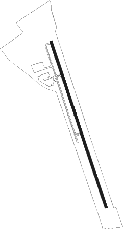
Runway info
| Runway 16 / 34 | ||
| length | 1530m (5020ft) | |
| bearing | 164° / 344° | |
| width | 23m (75ft) | |
| surface | asphalt | |
Nearby beacons
| code | identifier | dist | bearing | frequency |
|---|---|---|---|---|
| ECY | DURALDE (EUNICE) NDB | 5.7 | 345° | 263 |
| LFT | LAFAYETTE VORTAC | 27.7 | 122° | 109.80 |
| LF | LAFFS (LAFARETTE) NDB | 28.7 | 109° | 375 |
| BNZ | ABBEVILLE NDB | 28.8 | 143° | 230 |
| LCH | LAKE CHARLES VORTAC | 40.3 | 245° | 113.40 |
| CW | MOSSY (LAKE CHARLES) NDB | 41.1 | 258° | 418 |
| AEX | ALEXANDRIA VORTAC | 47.6 | 354° | 116.10 |
| LLA | WHITE LAKE VOR/DME | 48.2 | 176° | 110.40 |
| DXB | DE RIDDER NDB | 50.1 | 287° | 385 |
| AUR | SULFY (SULPHUR) NDB | 54.1 | 255° | 278 |
| FXU | POLK (FORT POLK) VOR | 56.4 | 309° | 108.40 |
Instrument approach procedures
| runway | airway (heading) | route (dist, bearing) |
|---|---|---|
| RW16 | BOZAN (258°) | BOZAN MIXER (13mi, 318°) 1700ft JEGIL (5mi, 258°) 1700ft |
| RW16 | HATHA (61°) | HATHA ETICA (20mi, 22°) 1700ft JEGIL (5mi, 78°) 1700ft |
| RW16 | JEGIL (164°) | JEGIL 1700ft |
| RNAV | JEGIL 1700ft ELAYE (6mi, 164°) 1700ft 4R7 (5mi, 164°) 91ft (5531mi, 108°) 580ft JEGIL (5533mi, 288°) 1700ft JEGIL (turn) | |
| RW34 | CRISP (20°) | CRISP FOLEN (8mi, 35°) 1800ft |
| RNAV | FOLEN 1800ft CEMIS (6mi, 16°) 1500ft 4R7 (5mi, 355°) 92ft (5531mi, 108°) 442ft CIGOM (5531mi, 288°) JEGIL (10mi, 341°) 1700ft JEGIL (turn) |
Disclaimer
The information on this website is not for real aviation. Use this data with the X-Plane flight simulator only! Data taken with kind consent from X-Plane 12 source code and data files. Content is subject to change without notice.