Seaside - Seaside Muni
Airport details
| Country | United States of America |
| State | Oregon |
| Region | |
| Airspace | Seattle Ctr |
| Municipality | Gearhart |
| Elevation | 4ft (1m) |
| Timezone | GMT -8 |
| Coordinates | 46.01802, -123.90774 |
| Magnetic var | |
| Type | land |
| Available since | X-Plane v10.40 |
| ICAO code | 56S |
| IATA code | n/a |
| FAA code | 56S |
Communication
| Seaside Muni ASOS at AST | 135.375 |
| Seaside Muni CTAF | 122.900 |
Nearby Points of Interest:
Daniel Knight Warren House
-Robert Rensselaer Bartlett House
-Norris Staples House
-George C. and Winona Flavel House
-Ferdinand Fisher House
-Peter L. Cherry House
-Albert W. Ferguson House
-John N. Griffin House
-Astoria Elks Building
-Captain George Conrad Flavel House
-Old Grace Episcopal Church Rectory
-Astoria City Hall
-Martin Foard House
-United States Post Office
-Samuel Elmore Cannery
-John Hobson House
-Old Astoria City Hall
-Astoria Wharf and Warehouse Company
-Astoria Fire House No. 2
-Peter and Maria Larson House
-Christian Leinenweber House
-MV Tourist No. 2
-Union Fishermen's Cooperative Packing Company Alderbrook Station
-Columbia River Quarantine Station
-Harry F. Wentz Studio
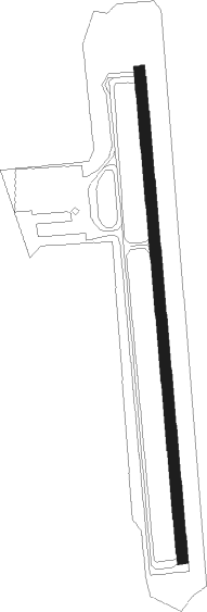
Runway info
| Runway 16 / 34 | ||
| length | 698m (2290ft) | |
| bearing | 179° / 359° | |
| width | 15m (50ft) | |
| surface | asphalt | |
| displ threshold | 46m (151ft) / 26m (85ft) | |
Nearby beacons
| code | identifier | dist | bearing | frequency |
|---|---|---|---|---|
| AST | ASTORIA VOR/DME | 8.7 | 11° | 114 |
| PND | BANKS (PORTLAND) NDB | 42.9 | 114° | 356 |
| UBG | NEWBERG VOR/DME | 55.8 | 126° | 117.40 |
| HQM | HOQUIAM VORTAC | 56.6 | 345° | 117.70 |
Disclaimer
The information on this website is not for real aviation. Use this data with the X-Plane flight simulator only! Data taken with kind consent from X-Plane 12 source code and data files. Content is subject to change without notice.