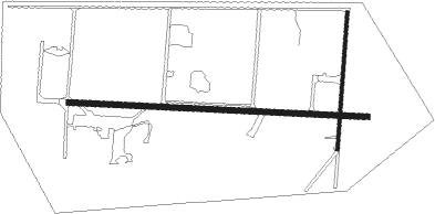
Borrego Springs - Borrego Air Ranch
Airport details
| Country | United States of America |
| State | California |
| Region | K2 |
| Airspace | Los Angeles Ctr |
| Municipality | CAL Fire San Diego Unit |
| Elevation | 575ft (175m) |
| Timezone | GMT -8 |
| Coordinates | 33.19171, -116.27584 |
| Magnetic var | |
| Type | land |
| Available since | X-Plane v10.40 |
| ICAO code | 58CL |
| IATA code | n/a |
| FAA code | 58CL |
Communication
| Borrego Air Ranch CTAF | 122.900 |
Nearby Points of Interest:
North Shore Beach and Yacht Club
-Desert View Tower
Nearby beacons
| code | identifier | dist | bearing | frequency |
|---|---|---|---|---|
| JLI | JULIAN VORTAC | 15.8 | 261° | 114 |
| TRM | THERMAL VORTAC | 26.8 | 15° | 116.20 |
| NJK | EL CENTRO TACAN | 36.9 | 121° | 111 |
| PSP | PALM SPRINGS VORTAC | 41.4 | 347° | 115.50 |
| IPL | IMPERIAL VORTAC | 46.9 | 120° | 115.90 |
| NKX | MIRAMAR (SAN DIEGO) TACAN | 48.2 | 250° | 109.60 |
| PGY | POGGI (SAN DIEGO) VORTAC | 49.7 | 230° | 116.45 |
| TIJ | TIJUANA VOR/DME | 51.9 | 226° | 116.50 |
| MZB | MISSION BAY (SAN DIEGO) VORTAC | 53.7 | 247° | 117.80 |
| NZY | NORTH ISLAND (SAN DIEGO) TACAN | 55.7 | 243° | 117 |
| NRS | IMPERIAL BEACH TACAN | 56.4 | 233° | 109.20 |
| HDF | HOMELAND (RIVERSIDE) VOR | 57.5 | 303° | 113.40 |
| TNP | TWENTYNINE PALMS VORTAC | 60.7 | 29° | 114.20 |
| RIV | MARCH (RIVERSIDE) TACAN | 65.9 | 306° | 113 |
Disclaimer
The information on this website is not for real aviation. Use this data with the X-Plane flight simulator only! Data taken with kind consent from X-Plane 12 source code and data files. Content is subject to change without notice.

