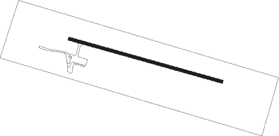
Jackman - Newton Field
Airport details
| Country | United States of America |
| State | Maine |
| Region | |
| Airspace | Boston Ctr |
| Municipality | Jackman |
| Elevation | 1178ft (359m) |
| Timezone | GMT -5 |
| Coordinates | 45.63283, -70.24883 |
| Magnetic var | |
| Type | land |
| Available since | X-Plane v10.40 |
| ICAO code | 59B |
| IATA code | n/a |
| FAA code | 59B |
Communication
Nearby Points of Interest:
Kineo Cottage Row Historic District
-St. John Anglican Church
-Lac-Mégantic railway station
-Katahdin
Runway info
| Runway 13 / 31 | ||
| length | 881m (2890ft) | |
| bearing | 104° / 284° | |
| width | 18m (60ft) | |
| surface | concrete | |
Nearby beacons
| code | identifier | dist | bearing | frequency |
|---|---|---|---|---|
| VLV | DME | 30.5 | 296° | 117.20 |
| RQM | RANGELEY NDB | 47 | 216° | 221 |
| BUP | BURNHAM (PITTSFIELD) NDB | 67.6 | 136° | 348 |
| BML | DME | 71.9 | 223° | 116.55 |
Instrument approach procedures
| runway | airway (heading) | route (dist, bearing) |
|---|---|---|
| RW13 | TRIER (80°) | TRIER 6400ft |
| RNAV | TRIER 6400ft REPLY (8mi, 68°) 3700ft JARBU (3mi, 90°) 2900ft MIBME (5mi, 90°) 1453ft (4585mi, 123°) 1578ft JIMBU (4568mi, 303°) 6000ft JIMBU (turn) 6000ft | |
| RW31-Y | OPIPE (273°) | OPIPE 6000ft |
| RNAV | OPIPE 6000ft BOUSE (8mi, 272°) 3500ft FEMAG (4mi, 272°) 2240ft CAKUP (3mi, 272°) 1380ft (4584mi, 123°) 1578ft CAMPO (4586mi, 303°) 6400ft CAMPO (turn) 6400ft |
Disclaimer
The information on this website is not for real aviation. Use this data with the X-Plane flight simulator only! Data taken with kind consent from X-Plane 12 source code and data files. Content is subject to change without notice.
