Okolona - Okolona Muni-stovall Field
Airport details
| Country | United States of America |
| State | Mississippi |
| Region | K7 |
| Airspace | Memphis Ctr |
| Municipality | Chickasaw County |
| Elevation | 333ft (101m) |
| Timezone | GMT -6 |
| Coordinates | 34.01580, -88.72620 |
| Magnetic var | |
| Type | land |
| Available since | X-Plane v10.40 |
| ICAO code | 5A4 |
| IATA code | n/a |
| FAA code | n/a |
Communication
| Okolona Muni-Stovall Field CTAF | 122.900 |
| Okolona Muni-Stovall Field COLUMBUS Approach/Departure | 126.075 |
Nearby Points of Interest:
Bynum Mound and Village Site
-Tombigbee State Park
-Reuben Davis House
-West Commerce Street Historic District
-Aberdeen City Hall
-United States Courthouse and Post Office
-North Broadway Historic District
-John Holliday House
-Judge Bates House
-Houston Carnegie Library
-Cox-Uithoven House
-Waverley
-James Greer Bankhead House
Runway info
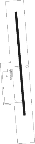
| Runway 18 / 36 | ||
| length | 975m (3199ft) | |
| bearing | 180° / 360° | |
| width | 18m (60ft) | |
| surface | asphalt | |
Nearby beacons
| code | identifier | dist | bearing | frequency |
|---|---|---|---|---|
| TU | VERON (TUPELO) NDB | 10.1 | 346° | 420 |
| OTB | TUPELO VOR/DME | 12.9 | 341° | 109.80 |
| CBM | CALEDONIA (COLUMBUS) VORTAC | 26.6 | 142° | 115.20 |
| IGB | BIGBEE (COLUMBUS) VORTAC | 33.5 | 158° | 116.20 |
| HAB | DME | 37.1 | 76° | 110.40 |
| UV | TUNNG (OXFORD) NDB | 49.8 | 292° | 426 |
| HLI | HOLLY SPRINGS VORTAC | 59.2 | 314° | 112.40 |
| UU | SEYER (CORINTH) NDB | 60.2 | 6° | 334 |
Instrument approach procedures
| runway | airway (heading) | route (dist, bearing) |
|---|---|---|
| RW18 | AYUDI (180°) | AYUDI 2600ft |
| RNAV | AYUDI 2600ft NELRY (6mi, 180°) 2000ft 5A4 (5mi, 180°) 374ft (5342mi, 111°) 621ft MUMDE (5342mi, 291°) 2000ft MUMDE (turn) | |
| RW36 | MUMDE (360°) | MUMDE 2000ft |
| RNAV | MUMDE 2000ft IXXEW (7mi, 360°) 2000ft 5A4 (5mi, 360°) 391ft (5342mi, 111°) 623ft AYUDI (5342mi, 291°) 2600ft AYUDI (turn) |
Disclaimer
The information on this website is not for real aviation. Use this data with the X-Plane flight simulator only! Data taken with kind consent from X-Plane 12 source code and data files. Content is subject to change without notice.