Taylorsville
Airport details
| Country | United States of America |
| State | North Carolina |
| Region | |
| Airspace | Atlanta Ctr |
| Municipality | Alexander County |
| Elevation | 1088ft (332m) |
| Timezone | GMT -5 |
| Coordinates | 35.92973, -81.20266 |
| Magnetic var | |
| Type | land |
| Available since | X-Plane v10.40 |
| ICAO code | 5A5 |
| IATA code | n/a |
| FAA code | NC2 |
Communication
| Taylorsville CTAF | 122.900 |
Nearby Points of Interest:
Hightower Hall
-Lucas Mansion
-Highland School
-John Alfred Moretz House
-Lee & Helen George House
-Shuford House
-Dula-Horton Cemetery
-Dr. Glenn R. Frye House
-J. T. Ferguson Store
-Johnson-Hubbard House
-Downtown Wilkesboro Historic District
-Wilkes County Courthouse
-Wilkesboro Presbyterian Church
-Old Wilkes County Jail
-Lyerly Full Fashioned Mill
-First Presbyterian Church
-Oakwood Historic District
-Claremont High School Historic District
-Harris Arcade
-Kenworth Historic District
-Hickory Municipal Building
-Elliott–Carnegie Library
-Hickory Southwest Downtown Historic District
-Clement Geitner House
-Houck's Chapel
Runway info
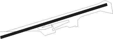
| Runway 09 / 27 | ||
| length | 741m (2431ft) | |
| bearing | 80° / 260° | |
| width | 18m (60ft) | |
| surface | grass | |
| blast zone | 1m (3ft) / 0m (0ft) | |
Nearby beacons
| code | identifier | dist | bearing | frequency |
|---|---|---|---|---|
| BZM | BARRETTS MOUNTAIN (HICKOR VOR/DME | 4 | 212° | 113.75 |
| HK | TAWBA (HICKORY) NDB | 9.9 | 216° | 332 |
| FIQ | FIDDLERS (MORGANTON) NDB | 26.3 | 245° | 391 |
| JUH | ASHEE (JEFFERSON) NDB | 30.8 | 347° | 410 |
| BAR | HEMLOCK (BANNER ELK) NDB | 35.5 | 288° | 320 |
| RU | ROVDY (SALISBURY) NDB | 36.6 | 105° | 275 |
| JJC | MOUNTAIN CITY NDB | 41.9 | 308° | 396 |
| GHJ | STONIA (GASTONIA) NDB | 44.3 | 177° | 260 |
| SLP | FIRST RIVER (SHELBY) NDB | 45 | 210° | 417 |
| CLT | CHARLOTTE VOR/DME | 46 | 161° | 115 |
| HMV | HOLSTON MOUNTAIN VORTAC | 54.2 | 299° | 114.60 |
| SPA | SPARTANBURG VORTAC | 64.4 | 219° | 115.70 |
| GZG | GLADE SPRING (BLACKFORD) VOR/DME | 68.4 | 316° | 110.20 |
Disclaimer
The information on this website is not for real aviation. Use this data with the X-Plane flight simulator only! Data taken with kind consent from X-Plane 12 source code and data files. Content is subject to change without notice.