North Ballston Spa - Saratoga County
Airport details
| Country | United States of America |
| State | New York |
| Region | K6 |
| Airspace | Boston Ctr |
| Municipality | Town of Milton |
| Elevation | 433ft (132m) |
| Timezone | GMT -5 |
| Coordinates | 43.05072, -73.86164 |
| Magnetic var | |
| Type | land |
| Available since | X-Plane v10.40 |
| ICAO code | 5B2 |
| IATA code | n/a |
| FAA code | 5B2 |
Communication
| Saratoga County AWOS | 132.025 |
| Saratoga County CTAF/UNICOM | 123.075 |
| Saratoga County ALBANY Approach/Departure | 118.050 |
Nearby Points of Interest:
Petrified Sea Gardens
-United States Post Office
-George West House
-Verbeck House
-Saratoga Springs Visitor Center
-Hiram Charles Todd House
-West Side Historic District
-Pure Oil Gas Station
-Broadway Historic District
-East Side Historic District
-Union Avenue Historic District
-Wiggins-Collamer House
-Ruhle Road Stone Arch Bridge
-Davis-Ferris Organ
-West Charlton United Presbyterian Church
-Cyrus Rexford House
-Bullard Block
-Gansevoort Mansion
-Knickerbocker Mansion
-Mechanicville Hydroelectric Plant
-Mabee House
-Enlarged Erie Canal Historic District
-Fort Miller Reformed Church Complex
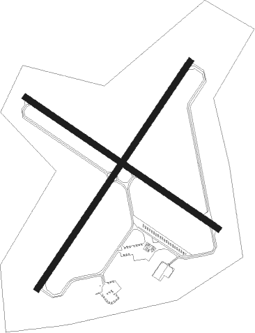
Runway info
Runway 5 / 23  | ||
| length | 1432m (4698ft) | |
| bearing | 47° / 227° | |
| width | 30m (100ft) | |
| surface | asphalt | |
| blast zone | 61m (200ft) / 61m (200ft) | |
| Runway 14 / 32 | ||
| length | 1218m (3996ft) | |
| bearing | 120° / 300° | |
| width | 30m (100ft) | |
| surface | asphalt | |
| blast zone | 0m (0ft) / 46m (151ft) | |
Nearby beacons
| code | identifier | dist | bearing | frequency |
|---|---|---|---|---|
| HEU | HUNTER (SCHENECTADY) NDB | 12.2 | 200° | 356 |
| AL | HAWKY (ALBANY) NDB | 14.2 | 167° | 219 |
| GF | GANSE (GLENS FALLS) NDB | 16.6 | 51° | 209 |
| ALB | ALBANY VORTAC | 18.4 | 169° | 115.30 |
| JJH | JOHNSTOWN NDB | 20.8 | 264° | 523 |
| CAM | CAMBRIDGE VOR/DME | 22.9 | 96° | 115 |
| PFH | PHILMONT (HUDSON) NDB | 48.2 | 170° | 272 |
| RUT | DME | 49 | 62° | 111 |
| DYO | SMUTO (RUTLAND) NDB | 55.7 | 54° | 221 |
| CTR | CHESTER VOR/DME | 60.8 | 130° | 115.10 |
Instrument approach procedures
| runway | airway (heading) | route (dist, bearing) |
|---|---|---|
| RW05 | ALB (349°) | ALB YARUS (8mi, 308°) 3500ft WALTU (5mi, 300°) 3000ft |
| RW05 | ROOMS (88°) | ROOMS UCANA (16mi, 98°) 4000ft ZANVA (5mi, 99°) 3500ft WALTU (5mi, 120°) 3000ft |
| RW05 | WALTU (47°) | WALTU 3000ft |
| RNAV | WALTU 3000ft ICOPA (6mi, 47°) 2100ft 5B2 (5mi, 47°) 480ft (4701mi, 120°) 834ft TAYVO (4696mi, 300°) 3000ft TAYVO (turn) | |
| RW23 | BOJAX (187°) | BOJAX TAYVO (8mi, 120°) 4100ft |
| RW23 | TAYVO (227°) | TAYVO 6000ft TAYVO (turn) 3000ft |
| RW23 | VACPU (257°) | VACPU TAYVO (8mi, 300°) 3000ft |
| RNAV | TAYVO 3000ft LOXFO (6mi, 227°) 2300ft WEVOP (4mi, 227°) 1140ft 5B2 (2mi, 227°) 482ft (4701mi, 120°) 698ft WALTU (4707mi, 300°) 3000ft WALTU (turn) |
Disclaimer
The information on this website is not for real aviation. Use this data with the X-Plane flight simulator only! Data taken with kind consent from X-Plane 12 source code and data files. Content is subject to change without notice.