Le Roy
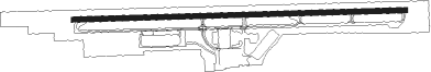
Airport details
| Country | United States of America |
| State | New York |
| Region | |
| Airspace | Cleveland Ctr |
| Municipality | Town of LeRoy |
| Elevation | 785ft (239m) |
| Timezone | GMT -5 |
| Coordinates | 42.98155, -77.94246 |
| Magnetic var | |
| Type | land |
| Available since | X-Plane v10.40 |
| ICAO code | 5G0 |
| IATA code | n/a |
| FAA code | 5G0 |
Communication
Nearby Points of Interest:
Le Roy House and Union Free School
-United States Post Office
-Keeney House
-First Presbyterian Church of Le Roy
-Clark-Keith House
-William Shirts House
-Wheatland Baptist Cemetery
-Stafford Village Four Corners Historic District
-Riga Academy
-Donald Mann House
-Lake Street Historic District
-Linwood
-Romanta T. Miller House
-David McVean House
-Simeon Sage House
-Isaac Cox Cobblestone Farmstead
-Union Presbyterian Church
-Scottsville Free Library
-Grace Church
-Rochester Street Historic District
-Gifford–Walker Farm
-Avon Five Arch Bridge
-Hall's Opera Block
-Aaron Barber Memorial Building
-J. Francis Kellogg House
Nearby beacons
| code | identifier | dist | bearing | frequency |
|---|---|---|---|---|
| GEE | GENESEO VOR/DME | 12.7 | 125° | 108.20 |
| ROC | ROCHESTER VOR/DME | 14.3 | 63° | 110 |
| BUF | BUFFALO VOR/DME | 31 | 266° | 116.40 |
| BU | KLUMP (BUFFALO) NDB | 31.1 | 272° | 231 |
| GB | PLAZZ (BUFFALO) NDB | 38.9 | 263° | 204 |
| IA | KATHI (NIAGRA FALLS) NDB | 40 | 278° | 329 |
| PYA | PENN YAN NDB | 43.9 | 111° | 260 |
| ELZ | DME | 53.6 | 184° | 111.40 |
| ULW | ELMIRA VOR/DME | 67 | 134° | 109.65 |
| YO | DME-ILS | 69.7 | 315° | 111.35 |
| OO | OSHAWA NDB | 70.1 | 314° | 391 |
Instrument approach procedures
| runway | airway (heading) | route (dist, bearing) |
|---|---|---|
| RW10 | AIRCO (113°) | AIRCO ZORPI (21mi, 122°) 3000ft |
| RW10 | DALEE (58°) | DALEE JUKIR (10mi, 37°) 3500ft ZORPI (6mi, 37°) 3000ft |
| RNAV | ZORPI 3000ft RULAE (4mi, 92°) 2200ft CESES (2mi, 92°) 1540ft 5G0 (2mi, 92°) 811ft (4877mi, 119°) 1500ft ZORPI (4885mi, 299°) 3000ft ZORPI (turn) | |
| RW28 | GEE (305°) | GEE BEYLA (7mi, 347°) 2500ft |
| RNAV | BEYLA 2500ft CUSUS (4mi, 295°) 2200ft 5G0 (5mi, 272°) 818ft (4877mi, 119°) 1180ft ZORPI (4885mi, 299°) 3000ft ZORPI (turn) |
Disclaimer
The information on this website is not for real aviation. Use this data with the X-Plane flight simulator only! Data taken with kind consent from X-Plane 12 source code and data files. Content is subject to change without notice.