Oakridge - Oakridge State
Airport details
| Country | United States of America |
| State | Oregon |
| Region | K1 |
| Airspace | Seattle Ctr |
| Municipality | Lane County |
| Elevation | 1393ft (425m) |
| Timezone | GMT -8 |
| Coordinates | 43.75256, -122.50452 |
| Magnetic var | |
| Type | land |
| Available since | X-Plane v10.40 |
| ICAO code | 5S0 |
| IATA code | n/a |
| FAA code | 5S0 |
Communication
| Oakridge State CTAF | 122.900 |
Nearby Points of Interest:
Musick Guard Station
-Lowell Grange
-Old McKenzie Fish Hatchery
-Cochran-Rice Farm Complex
-Row River National Recreation Trail
-Horace J. and Ann S. Shinn Cottage
-Jacob Clearwater House
-Methodist Episcopal Church of Goshen
-Brattain–Hadley House
-Southern Pacific Railroad Passenger Station and Freight House
-Springfield General Hospital
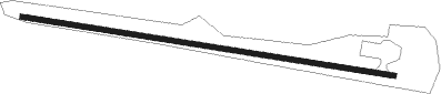
Runway info
| Runway 9 / 27 | ||
| length | 1101m (3612ft) | |
| bearing | 100° / 280° | |
| width | 14m (47ft) | |
| surface | asphalt | |
Nearby beacons
| code | identifier | dist | bearing | frequency |
|---|---|---|---|---|
| EUG | EUGENE VORTAC | 38.1 | 297° | 112.90 |
| RBG | ROSEBURG VOR/DME | 50.3 | 236° | 108.20 |
| CVO | CORVALLIS VOR/DME | 56.3 | 313° | 115.40 |
| LWG | LEWISBURG (CORVALLIS) NDB | 61.3 | 318° | 225 |
Disclaimer
The information on this website is not for real aviation. Use this data with the X-Plane flight simulator only! Data taken with kind consent from X-Plane 12 source code and data files. Content is subject to change without notice.