Maverick County Memorial International A - Maverick Co Meml Intl
Airport details
| Country | United States of America |
| State | Texas |
| Region | K4 |
| Airspace | Houston Oceanic Ctr |
| Municipality | Maverick County |
| Elevation | 887ft (270m) |
| Timezone | GMT -6 |
| Coordinates | 28.85709, -100.51347 |
| Magnetic var | |
| Type | land |
| Available since | X-Plane v10.40 |
| ICAO code | 5T9 |
| IATA code | n/a |
| FAA code | n/a |
Communication
| Maverick Co Meml Intl CTAF/UNICOM | 122.800 |
Nearby Points of Interest:
Fort Duncan
-Fort Clark, Texas
Runway info
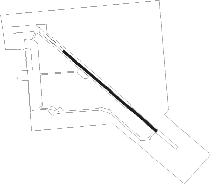
| Runway 13 / 31 | ||
| length | 1679m (5509ft) | |
| bearing | 131° / 311° | |
| width | 30m (100ft) | |
| surface | asphalt | |
Nearby beacons
| code | identifier | dist | bearing | frequency |
|---|---|---|---|---|
| PNG | PIEDRAS VOR/DME | 13.5 | 186° | 113.60 |
| PFO | SPOFFORD NDB | 17.8 | 17° | 356 |
| BRX | LA FONDA RANCH (BRACKETVILLE) NDB | 21.8 | 343° | 269 |
| CPZ | CHAPARROSA RANCH NDB | 27.3 | 88° | 385 |
| DLF | LAUGHLIN (DEL RIO) VORTAC | 33.1 | 333° | 114.40 |
| DR | KOTTI (DEL RIO) NDB | 43.2 | 321° | 335 |
Instrument approach procedures
| runway | airway (heading) | route (dist, bearing) |
|---|---|---|
| RW13 | COT (286°) | COT COKAD (64mi, 295°) 5000ft CEYAT (11mi, 295°) 5000ft AZOBE (10mi, 267°) 3500ft |
| RW13 | RSG (190°) | RSG CEYAT (58mi, 185°) 5000ft AZOBE (10mi, 267°) 3500ft |
| RW13 | SAT (249°) | SAT CEYAT (107mi, 253°) 5000ft AZOBE (10mi, 267°) 3500ft |
| RNAV | AZOBE 3500ft KUGEC (6mi, 180°) 2500ft BIRLS (2mi, 148°) 1780ft MESYU (2mi, 148°) 1079ft (5958mi, 106°) 1600ft COKAD (5940mi, 286°) 4000ft COKAD (turn) | |
| RW31 | COT (286°) | COT IYULI (65mi, 285°) 5000ft LUYIK (5mi, 229°) 3500ft |
| RW31 | RSG (190°) | RSG NEYIR (57mi, 180°) 5000ft IYULI (17mi, 180°) 5000ft LUYIK (5mi, 229°) 3500ft |
| RW31 | SAT (249°) | SAT IYULI (109mi, 245°) 5000ft LUYIK (5mi, 229°) 3500ft |
| RNAV | LUYIK 3500ft JINOV (6mi, 311°) 2500ft OCILU (3mi, 311°) 1400ft 5T9 (2mi, 311°) 922ft CEXEV (5mi, 311°) NEYIR (17mi, 65°) 4000ft NEYIR (turn) |
Disclaimer
The information on this website is not for real aviation. Use this data with the X-Plane flight simulator only! Data taken with kind consent from X-Plane 12 source code and data files. Content is subject to change without notice.