Crow Agency - Fort Smith Lndg Strip
Airport details
| Country | United States of America |
| State | Montana |
| Region | K1 |
| Airspace | Salt Lake City Ctr |
| Municipality | Big Horn County |
| Elevation | 3242ft (988m) |
| Timezone | GMT -7 |
| Coordinates | 45.32079, -107.93122 |
| Magnetic var | |
| Type | land |
| Available since | X-Plane v10.40 |
| ICAO code | 5U7 |
| IATA code | n/a |
| FAA code | n/a |
Communication
| FORT SMITH LNDG STRIP CTAF | 122.900 |
Nearby Points of Interest:
Bighorn Ditch Headgate
-Fort C. F. Smith
-Cedarvale
-Bad Pass Trail
-Hardin Commercial District
-James J. Sullivan House
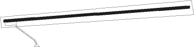
Runway info
| Runway 7 / 25 | ||
| length | 1158m (3799ft) | |
| bearing | 90° / 270° | |
| width | 15m (50ft) | |
| surface | asphalt | |
| displ threshold | 0m (0ft) / 44m (144ft) | |
Nearby beacons
| code | identifier | dist | bearing | frequency |
|---|---|---|---|---|
| HCY | COWLEY NDB | 32.6 | 232° | 257 |
| BIL | BILLINGS VORTAC | 41.3 | 305° | 114.50 |
| POY | POWELL NDB | 45.3 | 242° | 344 |
| SHR | SHERIDAN VOR/DME | 46.7 | 119° | 115.30 |
| GEY | GREYBULL NDB | 49 | 191° | 275 |
Disclaimer
The information on this website is not for real aviation. Use this data with the X-Plane flight simulator only! Data taken with kind consent from X-Plane 12 source code and data files. Content is subject to change without notice.