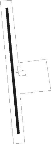
Camden - Camden Muni
Airport details
| Country | United States of America |
| State | Alabama |
| Region | K7 |
| Airspace | Atlanta Ctr |
| Municipality | Wilcox County |
| Elevation | 143ft (44m) |
| Timezone | GMT -6 |
| Coordinates | 31.97975, -87.33911 |
| Magnetic var | |
| Type | land |
| Available since | X-Plane v10.40 |
| ICAO code | 61A |
| IATA code | n/a |
| FAA code | n/a |
Communication
| Camden Muni CTAF | 122.900 |
Nearby Points of Interest:
Liberty Hall
-Tait-Ervin House
-Wilcox Female Institute
-Wilcox County Courthouse Historic District
-William King Beck House
-Tristram Bethea House
-Dry Fork Plantation
-Ackerville Baptist Church of Christ
-Snow Hill Normal and Industrial Institute
-Street Manual Training School
-Hawthorne House
-Pine Apple Historic District
-Furman Historic District
-Patrick Farrish House
-Thomaston Central Historic District
-C. S. Golden House
-J. Bruce Hain House
-Woodlands
-Fort Sinquefield
-William Poole House
-Whatley Historic District
-Half Chance Iron Bridge
-Bush House
-Dickinson House
-Alston-Cobb House
Nearby beacons
| code | identifier | dist | bearing | frequency |
|---|---|---|---|---|
| SE | POLLK (SELMA) NDB | 27.2 | 55° | 344 |
| MVC | MONROEVILLE VORTAC | 31.2 | 181° | 116.80 |
| MG | MARRA (MONTGOMERY) NDB | 46.6 | 68° | 245 |
| MXF | MAXWELL (MONTGOMERY) TACAN | 54.8 | 68° | 115 |
| JUY | JUDD (ANDALUSIA) NDB | 63.1 | 125° | 264 |
Instrument approach procedures
| runway | airway (heading) | route (dist, bearing) |
|---|---|---|
| RW18 | WRATH (179°) | WRATH 3000ft |
| RNAV | WRATH 3000ft TUGIE (9mi, 179°) 1800ft BIPDE (3mi, 179°) 980ft 61A (3mi, 179°) 193ft (5270mi, 110°) 543ft JOLUM (5269mi, 290°) 3500ft JOLUM (turn) | |
| RW36 | JOLUM (359°) | JOLUM 3000ft |
| RNAV | JOLUM 3000ft CAKLI (8mi, 359°) 1800ft ZIVKI (2mi, 359°) 1000ft 61A (3mi, 359°) 192ft (5270mi, 110°) 900ft JOLUM (5269mi, 290°) 3500ft JOLUM (turn) |
Disclaimer
The information on this website is not for real aviation. Use this data with the X-Plane flight simulator only! Data taken with kind consent from X-Plane 12 source code and data files. Content is subject to change without notice.
