Plainwell
Airport details
| Country | United States of America |
| State | Michigan |
| Region | |
| Airspace | Chicago Ctr |
| Municipality | Gun Plain Charter Township |
| Elevation | 722ft (220m) |
| Timezone | GMT -5 |
| Coordinates | 42.46747, -85.65211 |
| Magnetic var | |
| Type | land |
| Available since | X-Plane v10.40 |
| ICAO code | 61D |
| IATA code | n/a |
| FAA code | 61D |
Communication
| Plainwell CTAF/UNICOM | 122.800 |
Nearby Points of Interest:
Island Historic District
-American Seating Company Factory Complex
-Sarah Lowe Stedman House
-Marshall Street Historic District
-Austin H. and Frankie A. Dwight Summer House
-Edward D. Born House
-Griswold Civic Center Historic District
-Henry Franks House
-William H. Brown House
-Richland Historic District
-Old Fire House No. 4
-Henderson Park-West Main Hill Historic District
-Masonic Temple Building
-Oshtemo Town Hall
-Lawrence and Chapin Building
-Engine House No. 3
-Desenberg Building
-Haymarket Historic District
-South Street Historic District
-Ladies' Library Association Building
-East Campus
-Isaac Brown House
-Henry Montague House
-Vine Area Historic District
-William L. Welsh Terrace
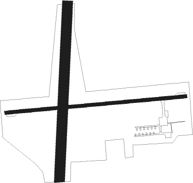
Runway info
Runway 9 / 27  | ||
| length | 805m (2641ft) | |
| bearing | 90° / 270° | |
| width | 15m (50ft) | |
| surface | asphalt | |
| displ threshold | 58m (190ft) / 236m (774ft) | |
| Runway 01 / 19 | ||
| length | 778m (2552ft) | |
| bearing | 10° / 190° | |
| width | 46m (150ft) | |
| surface | grass | |
| displ threshold | 82m (269ft) / 299m (981ft) | |
Nearby beacons
| code | identifier | dist | bearing | frequency |
|---|---|---|---|---|
| AZO | KALAMAZOO VOR/DME | 14.5 | 157° | 109 |
| PMM | PULLMAN VOR/DME | 20 | 270° | 112.10 |
| VIO | VICTORY VOR/DME | 20.3 | 26° | 115.95 |
| AZ | AUSTN (KALAMAZOO) NDB | 20.9 | 160° | 371 |
| BT | BATOL (BATTLE CREEK) NDB | 21.6 | 103° | 272 |
| GR | KNOBS (GRAND RAPIDS) NDB | 28.4 | 33° | 263 |
| ELX | KEELER VOR/DME | 28.5 | 236° | 116.60 |
| IRS | STURGIS NDB | 40.4 | 162° | 382 |
| MKG | MUSKEGON TACAN | 45.4 | 331° | 115.20 |
| LFD | LITCHFIELD VOR/DME | 46.3 | 115° | 111.20 |
| GIJ | GIPPER (NILES) VORTAC | 51.4 | 224° | 115.40 |
| SB | MISHA (SOUTH BEND) NDB | 52.2 | 217° | 341 |
| GSH | GOSHEN VORTAC | 59 | 202° | 113.70 |
Disclaimer
The information on this website is not for real aviation. Use this data with the X-Plane flight simulator only! Data taken with kind consent from X-Plane 12 source code and data files. Content is subject to change without notice.