Fowlerville - Maple Grove
Airport details
| Country | United States of America |
| State | Michigan |
| Region | |
| Airspace | Cleveland Ctr |
| Municipality | Conway Township |
| Elevation | 908ft (277m) |
| Timezone | GMT -5 |
| Coordinates | 42.71725, -84.06246 |
| Magnetic var | |
| Type | land |
| Available since | X-Plane v10.40 |
| ICAO code | 65G |
| IATA code | n/a |
| FAA code | 65G |
Communication
| Maple Grove CTAF | 122.800 |
Nearby Points of Interest:
Frank J. Hecox House
-Ann Arbor Railway Howell Depot
-Howell Downtown Historic District
-Livingston County Courthouse
-William K. and Nellie (Harper) Sexton House
-Charles H. Calkins House
-Isaac R. Middlesworth Farm House
-William Horton Farmhouse
-William Henry and Lucinda McCaslin Farm House
-Genesee Avenue–Walker Street Historic District
-House at 7066 Lobdell Road
-James H. Murray House
-St. Katherine's Chapel
-Bridge Street-Broad Street Historic District
-Martin Road Bridge
-August Westphal Farmstead
-Jesse H. Buck Farm House
-Shiawassee County Courthouse
-Dibbleville-Fentonville Historic District
-Edwin Trump House
-Fenton Railroad Depot
-Western House (Brighton, Michigan)
-Goetsch-Winckler House
-Stockbridge Town Hall
-Eustace Hall
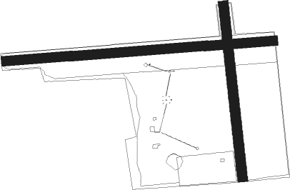
Runway info
Runway 09 / 27  | ||
| length | 924m (3031ft) | |
| bearing | 90° / 270° | |
| width | 34m (110ft) | |
| surface | grass | |
| displ threshold | 63m (207ft) / 90m (295ft) | |
| Runway 18 / 36 | ||
| length | 603m (1978ft) | |
| bearing | 178° / 358° | |
| width | 34m (113ft) | |
| surface | grass | |
| displ threshold | 165m (541ft) / 86m (282ft) | |
Nearby beacons
| code | identifier | dist | bearing | frequency |
|---|---|---|---|---|
| FNT | FLINT VORTAC | 20.4 | 52° | 116.90 |
| PSI | DME | 23.3 | 92° | 111 |
| SVM | SALEM VORTAC | 27.8 | 123° | 114.30 |
| JXN | DME | 32.6 | 221° | 115.45 |
| TCU | TECUMSEH NDB | 41.7 | 166° | 239 |
| DXO | DETROIT VOR/DME | 43.2 | 126° | 113.40 |
| MB | OLSTE (SAGINAW) NDB | 44.9 | 351° | 257 |
| DT | REVUP (DETROIT) NDB | 45.4 | 133° | 388 |
| CRL | CARLETON VOR/DME | 48.3 | 138° | 115.70 |
| DM | SPENC (DETROIT) NDB | 48.3 | 120° | 223 |
| MBS | SAGINAW VOR/DME | 48.9 | 359° | 112.90 |
| LFD | LITCHFIELD VOR/DME | 50.1 | 227° | 111.20 |
| ADG | ADRIAN NDB | 50.8 | 181° | 278 |
| RYS | GROSSE ILE (DETROIT) NDB | 54.7 | 124° | 419 |
| MOP | MOUNT PLEASANT VOR/DME | 61.8 | 323° | 110.60 |
Disclaimer
The information on this website is not for real aviation. Use this data with the X-Plane flight simulator only! Data taken with kind consent from X-Plane 12 source code and data files. Content is subject to change without notice.