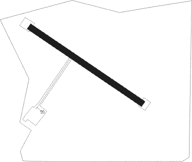
Saint Laurent De La Salanque - La Salanque
Airport details
| Country | France |
| State | Occitania |
| Region | LF |
| Airspace | Marseille Ctr |
| Municipality | Saint-Laurent-de-la-Salanque |
| Elevation | 0ft (0m) |
| Timezone | GMT +1 |
| Coordinates | 42.79490, 2.99870 |
| Magnetic var | |
| Type | land |
| Available since | X-Plane v10.40 |
| ICAO code | 6628 |
| IATA code | n/a |
| FAA code | n/a |
Communication
Nearby Points of Interest:
Église Saint-Laurent de Saint-Laurent-de-la-Salanque
-Église de Saint-Hippolyte
-colonne milliaire de Saint-Hippolyte
-Château de Saint-Hippolyte
-Ruscino
-Église Saint Jean l'évangéliste de Peyrestortes
-monument aux morts de 1870-71
-Couvent des Frères Prêcheurs
-Caserne Saint-Jacques
-Hôtel Saint-Antoine
-Inlaid stone in font de na Pincarda
-Casa Xanxo
-Hôtel Pams
-Église des Carmes
-bourse du travail de Perpignan
-Maison Julia
-Hôtel de ville de Perpignan
-Hôtel de Senesterra
-Palais de la Députation
-Couvent Sainte Claire de Perpignan
-Église Sainte-Colombe de Cases-de-Pène
-Bornes milliaires de Roquefort-des-Corbières
-Église Sainte-Marie de Las Fonts
-Porte fortifiée de Pézilla-la-Rivière
-Elne war memorial
Nearby beacons
| code | identifier | dist | bearing | frequency |
|---|---|---|---|---|
| PPG | PERPIGNAN RIVESALTES VOR/DME | 6.3 | 251° | 117.20 |
| PL | RIVESALTES (PERPIGNAN) NDB | 7.6 | 213° | 351 |
| ZR | BEZIERS VIAS NDB | 34.3 | 28° | 397 |
| ZR | VIAS DME-ILS | 35.1 | 33° | 109.35 |
| CS | CARCASSONNE SALVAZA NDB | 43.2 | 298° | 345 |
| GRN | GERONA (GIRONA) NDB | 47 | 194° | 412 |
| SAL | SAINTE LEOCADIE NDB | 48.3 | 251° | 418 |
| BGR | BAGUR VOR/DME | 51.7 | 166° | 112.20 |
| GIR | GERONA (GIRONA) VOR/DME | 52.8 | 195° | 114.10 |
| G | GIRONA NDB | 53.1 | 195° | 330 |
| CVU | CASTRES-MAZAMET NDB | 61 | 317° | 356 |
| FJR | MONTPELLIER MEDITERRANEE VOR/DME | 63.5 | 51° | 114.45 |
Disclaimer
The information on this website is not for real aviation. Use this data with the X-Plane flight simulator only! Data taken with kind consent from X-Plane 12 source code and data files. Content is subject to change without notice.