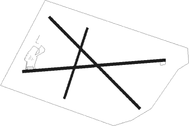
Huntington
Airport details
| Country | United States of America |
| State | Utah |
| Region | K2 |
| Airspace | Salt Lake City Ctr |
| Municipality | Emery County |
| Elevation | 5915ft (1803m) |
| Timezone | GMT -7 |
| Coordinates | 39.36123, -110.91698 |
| Magnetic var | |
| Type | land |
| Available since | X-Plane v10.40 |
| ICAO code | 69V |
| IATA code | n/a |
| FAA code | n/a |
Communication
| Huntington CTAF/UNICOM | 122.800 |
| Huntington SALT LAKE ARTCC APCH/Departure | 133.900 |
Nearby Points of Interest:
Castle Dale School
-Cleveland-Lloyd Dinosaur Quarry
-U.S. Post Office-Price Main
-Parker and Weeter Block
-Helper Commercial District
-U.S. Post Office-Helper Main
-San Rafael Bridge
-Mount Pleasant Carnegie Library
-Mount Pleasant National Guard Armory
-Mount Pleasant High School Mechanical Arts Building
-James B. Staker House
-W.D. Candland House
-Spring City
-Spring City School
-Morten Rasmussen House
-John H. Seely House
-Fairview City Hall
-Fairview Amusement Hall
-Emery LDS Church
-Noyes Building
-Fredrick Christian Sorensen House
-Ephraim United Order Cooperative Building
-Canute Peterson House
-Johnson-Nielson House
-Ephraim Carnegie Library
Nearby beacons
| code | identifier | dist | bearing | frequency |
|---|---|---|---|---|
| PUC | CARBON (PRICE) VOR/DME | 16.3 | 34° | 115.50 |
| HVE | HANKSVILLE VORTAC | 57.6 | 167° | 115.90 |
| MTU | MYTON VOR/DME | 59.7 | 45° | 112.70 |
| PVU | PROVO VOR/DME | 63.2 | 317° | 108.40 |
Instrument approach procedures
| runway | airway (heading) | route (dist, bearing) |
|---|---|---|
| RWNVC | ARBIH (178°) | ARBIH PUC (10mi, 120°) 11100ft TIVPE (5mi, 214°) 9400ft |
| RNAV | TIVPE 9400ft MYZER (7mi, 214°) 7800ft CEGVO (4mi, 214°) 6600ft (6367mi, 110°) 6600ft PUC (6357mi, 290°) 10000ft PUC (turn) |
Disclaimer
The information on this website is not for real aviation. Use this data with the X-Plane flight simulator only! Data taken with kind consent from X-Plane 12 source code and data files. Content is subject to change without notice.

