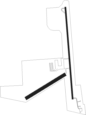
Butler - Butler Muni
Airport details
| Country | United States of America |
| State | Georgia |
| Region | K7 |
| Airspace | Atlanta Ctr |
| Municipality | Butler |
| Elevation | 666ft (203m) |
| Timezone | GMT -5 |
| Coordinates | 32.56977, -84.24518 |
| Magnetic var | |
| Type | land |
| Available since | X-Plane v10.40 |
| ICAO code | 6A1 |
| IATA code | n/a |
| FAA code | 6A1 |
Communication
| Butler Muni CTAF | 122.900 |
Nearby Points of Interest:
Butler Downtown Historic District
-Taylor County Courthouse
-Old Marion County Courthouse
-Peach County Courthouse
-Macon County Courthouse
-Upson County Courthouse
-Schley County Courthouse
-Marion County Courthouse
-Pasaquan
-William Barker Whiskey Bonding Barn
-Warm Springs Historic District
-Lamar County Courthouse
-Carnegie Library of Barnesville
-Barnesville Depot
-Benjamin Gachet House
-Eleanor Roosevelt School
-Chattahoochee County Jail
-Lilly Historic District
-Monroe County Courthouse
-Pike County Courthouse
-Villa Albicini
-Warner Robins Depot
-Ingleside Historic District
-Webster County Jails
-Webster County Courthouse
Nearby beacons
| code | identifier | dist | bearing | frequency |
|---|---|---|---|---|
| IZS | MONTEZUMA NDB | 17.1 | 130° | 426 |
| OP | YATES (THOMASTON) NDB | 21.1 | 9° | 339 |
| LKG | LINDBERGH (AMERICUS) NDB | 24.7 | 161° | 242 |
| ACJ | SOUTHER (AMERICUS) NDB | 27.6 | 173° | 242 |
| MCN | MACON VORTAC | 31.1 | 79° | 114.20 |
| WRB | ROBINS (WARNER ROBINS) TACAN | 33.3 | 84° | 135.30 |
| CSG | COLUMBUS VORTAC | 39.1 | 273° | 117.10 |
| OHY | CONEY (CORDELE) NDB | 39.4 | 146° | 400 |
| LSF | LAWSON (COLUMBUS) VOR/DME | 40.5 | 252° | 111.40 |
| CS | FENIX (COLUMBUS) NDB | 40.9 | 262° | 355 |
| AWS | LAWSON (COLUMBUS) NDB | 42.8 | 250° | 335 |
| VNA | VIENNA VORTAC | 43.5 | 115° | 116.50 |
| FFC | PECAT (ATLANTA) NDB | 45.5 | 342° | 316 |
| EQQ | COWETA COUNTY (NEWNAN) NDB | 47.5 | 326° | 234 |
| PZD | PECAN (ALBANY) VOR/DME | 54.9 | 183° | 116.10 |
| LGC | LA GRANGE VORTAC | 56.4 | 297° | 115.60 |
| EUF | EUFAULA VORTAC | 58.3 | 235° | 109.20 |
| GPQ | CARROLLTON NDB | 74.6 | 318° | 278 |
Instrument approach procedures
| runway | airway (heading) | route (dist, bearing) |
|---|---|---|
| RW01 | VOTUC (0°) | VOTUC 6000ft VOTUC (turn) 3300ft |
| RNAV | VOTUC 3300ft PEYLI (6mi, 0°) 2300ft 6A1 (5mi, 0°) 719ft (5114mi, 111°) 934ft JUNKU (5115mi, 291°) 3000ft JUNKU (turn) | |
| RW19 | JUNKU (180°) | JUNKU JUNKU (turn) 3500ft |
| RNAV | JUNKU 3500ft CUVDA (6mi, 180°) 2300ft 6A1 (6mi, 180°) 661ft (5114mi, 111°) 847ft VOTUC (5113mi, 291°) 3000ft VOTUC (turn) |
Disclaimer
The information on this website is not for real aviation. Use this data with the X-Plane flight simulator only! Data taken with kind consent from X-Plane 12 source code and data files. Content is subject to change without notice.

