Griffin - Griffin-spaulding County
Airport details
| Country | United States of America |
| State | Georgia |
| Region | K7 |
| Airspace | Atlanta Ctr |
| Municipality | Griffin |
| Elevation | 958ft (292m) |
| Timezone | GMT -5 |
| Coordinates | 33.22399, -84.27008 |
| Magnetic var | |
| Type | land |
| Available since | X-Plane v10.40 |
| ICAO code | 6A2 |
| IATA code | n/a |
| FAA code | n/a |
Communication
| Griffin-Spaulding County AWOS 3 | 119.750 |
| Griffin-Spaulding County CTAF/UNICOM | 123.075 |
| Griffin-Spaulding County ATLANTA Approach/Departure | 119.800 |
Nearby Points of Interest:
Hill-Kurtz House
-Bailey-Tebault House
-Sam Bailey Building
-Old Spalding County Courthouse
-Mills House
-Old Gaissert Homeplace
-Double Cabins
-Pike County Courthouse
-Benjamin Gachet House
-Locust Grove Historic District
-Locust Grove Institute
-Barnesville Depot
-Carnegie Library of Barnesville
-Lamar County Courthouse
-Crawford-Dorsey House and Cemetery
-Brown House
-McDonough Historic District
-Henry County Courthouse
-White Oak Creek Covered Bridge
-J. R. Carmichael House
-Butts County Courthouse
-William Barker Whiskey Bonding Barn
-Holliday-Dorsey-Fife House
-Idlewilde
-Stately Oaks
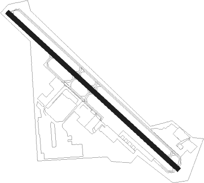
Runway info
| Runway 14 / 32 | ||
| length | 1129m (3704ft) | |
| bearing | 132° / 312° | |
| width | 23m (75ft) | |
| surface | asphalt | |
| displ threshold | 61m (200ft) / 61m (200ft) | |
Nearby beacons
| code | identifier | dist | bearing | frequency |
|---|---|---|---|---|
| FFC | PECAT (ATLANTA) NDB | 11.8 | 290° | 316 |
| OP | YATES (THOMASTON) NDB | 18.7 | 165° | 339 |
| EQQ | COWETA COUNTY (NEWNAN) NDB | 22.3 | 274° | 234 |
| ATL | ATLANTA VORTAC | 25.6 | 338° | 116.90 |
| AT | CATTA (ATLANTA) NDB | 28.8 | 327° | 375 |
| VOF | ALCOVY (COVINGTON) NDB | 34.5 | 50° | 370 |
| PDK | PEACHTREE (ATLANTA) VOR/DME | 39.1 | 357° | 116.60 |
| DOB | DOBBINS (MARIETTA) TACAN | 43.1 | 341° | 113 |
| MCN | MACON VORTAC | 44.8 | 131° | 114.20 |
| GPQ | CARROLLTON NDB | 47.8 | 292° | 278 |
| LGC | LA GRANGE VORTAC | 48.2 | 259° | 115.60 |
| WRB | ROBINS (WARNER ROBINS) TACAN | 48.9 | 131° | 135.30 |
| TX | GWNET (LAWRENCEVILLE) NDB | 51.9 | 27° | 419 |
| CSG | COLUMBUS VORTAC | 52.5 | 231° | 117.10 |
| IZS | MONTEZUMA NDB | 53.1 | 163° | 426 |
| BMW | BARROW COUNTY (WINDER) NDB | 54.6 | 44° | 404 |
| CS | FENIX (COLUMBUS) NDB | 60.5 | 225° | 355 |
| FKV | FLOWERY BRANCH (GAINESVILLE) NDB | 61.5 | 20° | 365 |
| AHN | ATHENS VOR/DME | 64.2 | 53° | 109.60 |
| LSF | LAWSON (COLUMBUS) VOR/DME | 64.8 | 219° | 111.40 |
| AWS | LAWSON (COLUMBUS) NDB | 67.6 | 219° | 335 |
| RMG | ROME VORTAC | 70.5 | 318° | 115.40 |
Departure and arrival routes
| Transition altitude | 18000ft |
| Transition level | 18000ft |
| STAR starting points | distance | inbound heading | |
|---|---|---|---|
| ALL | |||
| BUKHD3 | 87.0 | 146° | |
| DEHAN3 | 76.7 | 193° | |
Instrument approach procedures
| runway | airway (heading) | route (dist, bearing) |
|---|---|---|
| RW14 | FFC (110°) | FFC OTZEJ (5mi, 55°) 3000ft |
| RW14 | JEANI (157°) | JEANI OTZEJ (5mi, 232°) 3000ft |
| RW14 | OTZEJ (132°) | OTZEJ 3000ft |
| RNAV | OTZEJ 3000ft GUPVE (6mi, 132°) 2200ft 6A2 (4mi, 131°) 998ft (5117mi, 112°) 1320ft LUFEV (5110mi, 291°) 3000ft LUFEV (turn) | |
| RW32 | ETZIM (341°) | ETZIM 3000ft LUFEV (5mi, 52°) 3000ft |
| RW32 | IDEVY (288°) | IDEVY 3000ft LUFEV (5mi, 232°) 3000ft |
| RW32 | LUFEV (312°) | LUFEV 3000ft |
| RNAV | LUFEV 3000ft ZUKSI (6mi, 312°) 2200ft 6A2 (4mi, 313°) 977ft (5117mi, 112°) 1500ft LUFEV (5110mi, 291°) 3000ft LUFEV (turn) |
Holding patterns
| STAR name | hold at | type | turn | heading* | altitude | leg | speed limit |
|---|---|---|---|---|---|---|---|
| BUKHD3 | HLNDS | VHF | right | 327 (147)° | DME 10.0mi | ICAO rules | |
| DEHAN3 | AWSON | VHF | left | 29 (209)° | DME 10.0mi | ICAO rules | |
| DEHAN3 | TRALZ | VHF | right | 32 (212)° | DME 10.0mi | ICAO rules | |
| *) magnetic outbound (inbound) holding course | |||||||
Disclaimer
The information on this website is not for real aviation. Use this data with the X-Plane flight simulator only! Data taken with kind consent from X-Plane 12 source code and data files. Content is subject to change without notice.