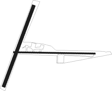
Skaneateles - Skaneateles Aero Drome
Airport details
| Country | United States of America |
| State | New York |
| Region | K6 |
| Airspace | New York Ctr |
| Municipality | Town of Skaneateles |
| Elevation | 1038ft (316m) |
| Timezone | GMT -5 |
| Coordinates | 42.91396, -76.44077 |
| Magnetic var | |
| Type | land |
| Available since | X-Plane v10.40 |
| ICAO code | 6B9 |
| IATA code | n/a |
| FAA code | n/a |
Communication
| Skaneateles Aero Drome CTAF/UNICOM | 122.800 |
| Skaneateles Aero Drome SYRACUSE Approach/Departure | 126.125 |
Nearby Points of Interest:
Reuel E. Smith House
-James and Lydia Canning Fuller House
-Hazelhurst
-Skaneateles Historic District
-Community Place
-Kelsey-Davey Farm
-Shepard Settlement Cemetery
-South Street Area Historic District
-Borodino District School No. 8
-William H. Seward House
-Borodino Hall
-Shines Auburn Theater
-Harriet Tubman National Historical Park
-Cayuga County Courthouse and Clerk's Office
-Old Post Office and Courthouse
-Dan Bradley House
-Case Memorial-Seymour Library
-Harriet Tubman grave
-Dr. Sylvester Willard Mansion
-Wall Street Methodist Episcopal Church
-Elbridge Village Historic District
-Martisco Station
-New Hope Mills Complex
-Orrin W. Burritt House
-Centreport Aqueduct
Nearby beacons
| code | identifier | dist | bearing | frequency |
|---|---|---|---|---|
| SYR | SYRACUSE VORTAC | 18 | 44° | 117 |
| FZ | FALLN (FULTON) NDB | 23.2 | 20° | 220 |
| ITH | DME | 25.1 | 183° | 111.80 |
| GGT | GEORGETOWN TACAN | 28 | 102° | 117.80 |
| IT | VRNAH (ITHACA) NDB | 29.2 | 171° | 266 |
| PYA | PENN YAN NDB | 31.6 | 246° | 260 |
| ALP | ALPINE (ELMIRA) NDB | 43 | 206° | 245 |
| CFB | BINGHAMTON VOR/DME | 47.3 | 158° | 112.20 |
| ULW | ELMIRA VOR/DME | 55.6 | 215° | 109.65 |
Instrument approach procedures
| runway | airway (heading) | route (dist, bearing) |
|---|---|---|
| RWNVA | ELIBE (94°) | ELIBE 3500ft |
| RWNVA | QUINE (74°) | QUINE ELIBE (7mi, 7°) 3500ft |
| RWNVA | ZEMLI (114°) | ZEMLI ELIBE (7mi, 187°) 3500ft |
| RNAV | ELIBE 3500ft TUDLE (9mi, 94°) 2600ft 6B9 (5mi, 94°) 1049ft (4811mi, 119°) 1439ft DULAY (4797mi, 299°) 3800ft DULAY (turn) | |
| RWNVB | DULAY (294°) | DULAY PRIMM (7mi, 8°) 3800ft |
| RWNVB | PRIMM (274°) | PRIMM 3800ft |
| RWNVB | WALOS (255°) | WALOS PRIMM (7mi, 188°) 3800ft |
| RNAV | PRIMM 3800ft NOROE (7mi, 274°) 3300ft STOKK (3mi, 274°) 2200ft 6B9 (4mi, 274°) 1044ft (4811mi, 119°) 1439ft ELIBE (4825mi, 299°) 3500ft ELIBE (turn) |
Disclaimer
The information on this website is not for real aviation. Use this data with the X-Plane flight simulator only! Data taken with kind consent from X-Plane 12 source code and data files. Content is subject to change without notice.

