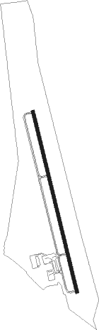
Pelion - Lexington County At Pelion
Airport details
| Country | United States of America |
| State | South Carolina |
| Region | K7 |
| Airspace | Jacksonville Ctr |
| Municipality | Pelion |
| Elevation | 451ft (137m) |
| Timezone | GMT -5 |
| Coordinates | 33.79464, -81.24586 |
| Magnetic var | |
| Type | land |
| Available since | X-Plane v10.40 |
| ICAO code | 6J0 |
| IATA code | n/a |
| FAA code | 6J0 |
Communication
| Lexington County At Pelion CTAF/UNICOM | 123.000 |
| Lexington County At Pelion COLUMBIA Approach/Departure | 124.150 |
Nearby Points of Interest:
C.E. Corley House
-Maj. Henry A. Meetze House
-Home National Bank
-Bank of Western Carolina
-Lexington County Courthouse
-Simmons-Harth House
-James Harman Building
-David Rawl House
-Charlton Rauch House
-Lemuel Boozer House
-W. Q. M. Berly House
-William Berly House
-Ernest L. Hazelius House
-Fox House
-John Solomon Hendrix House
-Mount Hebron Temperance Hall
-Salley Historic District
-William J. Cayce House
-Still Hopes
-Gunter-Summers House
-Church Street Historic District
-Guignard Brick Works
-New Brookland Historic District
-Granby Mill Village Historic District
-Olympia Mill
Nearby beacons
| code | identifier | dist | bearing | frequency |
|---|---|---|---|---|
| CAE | COLUMBIA VORTAC | 10.2 | 72° | 114.70 |
| CA | MURRY (COLUMBIA) NDB | 10.3 | 0° | 362 |
| AIK | AIKEN NDB | 23.1 | 252° | 347 |
| MMT | MC ENTIRE (COLUMBIA) VORTAC | 23.4 | 74° | 113.20 |
| EOE | ENOREE (NEWBERRY) NDB | 36.5 | 323° | 278 |
| SSC | SHAW (SUMTER) TACAN | 40.3 | 77° | 110.10 |
| EMR | EMORY (AUGUSTA) NDB | 42.5 | 246° | 385 |
| VAN | VANCE VORTAC | 44.2 | 112° | 110.40 |
| SMS | SUMTER NDB | 45.7 | 78° | 252 |
| IRQ | COLLIERS VORTAC | 46 | 265° | 113.90 |
| AG | BUSHE (AUGUSTA) NDB | 46.4 | 234° | 233 |
| ALD | ALLENDALE VOR | 47 | 183° | 116.70 |
| GIW | CORONACA (GREENWOOD) NDB | 50.1 | 299° | 239 |
| GRD | GREENWOOD VORTAC | 52.8 | 297° | 115.50 |
| UOT | UNION COUNTY NDB | 56.9 | 336° | 326 |
| LKR | LANCASTER NDB | 58.9 | 23° | 400 |
| DCM | CHESTER NDB | 59.5 | 3° | 220 |
| DYB | DORCHESTER COUNTY(SUMMERVILLE) NDB | 65.5 | 127° | 365 |
| CTF | CHESTERFIELD VOR/DME | 70.4 | 49° | 108.20 |
Instrument approach procedures
| runway | airway (heading) | route (dist, bearing) |
|---|---|---|
| RW18 | LEDAS (130°) | LEDAS SOYOP (13mi, 108°) 2700ft |
| RNAV | SOYOP 2700ft CUSUM (4mi, 169°) 2100ft WUSOD (3mi, 169°) 1140ft 6J0 (2mi, 169°) 491ft (4969mi, 113°) 756ft ZIDBI (4966mi, 292°) 2700ft ZIDBI (turn) | |
| RW36 | NORMS (354°) | NORMS ZIDBI (18mi, 357°) 2700ft |
| RW36 | ZIDBI (349°) | ZIDBI 2700ft |
| RNAV | ZIDBI 2700ft YORUT (4mi, 349°) 2100ft ODUCO (3mi, 349°) 1080ft 6J0 (2mi, 349°) 483ft (4969mi, 113°) 756ft ZIDBI (4966mi, 292°) 2700ft ZIDBI (turn) |
Disclaimer
The information on this website is not for real aviation. Use this data with the X-Plane flight simulator only! Data taken with kind consent from X-Plane 12 source code and data files. Content is subject to change without notice.