Creighton - Creighton Muni
Airport details
| Country | United States of America |
| State | Nebraska |
| Region | K3 |
| Airspace | Minneapolis Ctr |
| Municipality | Knox County |
| Elevation | 1652ft (504m) |
| Timezone | GMT -6 |
| Coordinates | 42.47128, -97.88475 |
| Magnetic var | |
| Type | land |
| Available since | X-Plane v10.40 |
| ICAO code | 6K3 |
| IATA code | n/a |
| FAA code | 6K3 |
Communication
| Creighton Muni CTAF | 122.900 |
Nearby Points of Interest:
Winnetoon Jail
-Knox County Courthouse
-Plainview Carnegie Library
-Fremont, Elkhorn and Missouri Valley Railroad Depot
-Z.C.B.J. Opera House
-Verdigris Creek Bridge
-Ashfall Fossil Beds
-Pospeshil Theatre
-Ponca Tribal Self-Help Community Building Historic District
-Willow Creek Bridge
-Rad Sladkovsky
-Gates College Gymnasium
-Maybury–McPherson House
-St. Peter's Episcopal Church
-Elkhorn River Bridge
-Kester Planing Mill
-Congregational Church and Manse
-Church of Our Most Merciful Saviour
-Argo Hotel
-Warrick House
-Hartington Hotel
-Cedar County Courthouse
-Hartington City Hall and Auditorium
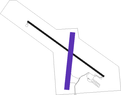
Runway info
Runway 13 / 31  | ||
| length | 1129m (3704ft) | |
| bearing | 122° / 302° | |
| width | 18m (60ft) | |
| surface | concrete | |
| Runway 18 / 36 | ||
| length | 641m (2103ft) | |
| bearing | 194° / 14° | |
| width | 61m (200ft) | |
| surface | grass | |
Nearby beacons
| code | identifier | dist | bearing | frequency |
|---|---|---|---|---|
| YK | CAGUR (YANKTON) NDB | 34 | 57° | 347 |
| YKN | YANKTON VOR/DME | 34.7 | 48° | 111.40 |
| OFK | NORFOLK VOR/DME | 35.2 | 137° | 109.60 |
| ONL | O'NEILL VORTAC | 35.5 | 270° | 113.90 |
| AGZ | WAGNER NDB | 39.8 | 325° | 392 |
| PLT | PLATTE CENTER (COLUMBUS) NDB | 62.6 | 153° | 407 |
Instrument approach procedures
| runway | airway (heading) | route (dist, bearing) |
|---|---|---|
| RW13 | ONL (90°) | ONL WABEX (26mi, 73°) 4000ft JIPEV (5mi, 122°) 4000ft |
| RW13 | TYNDA (186°) | TYNDA WABEX (27mi, 221°) 4000ft JIPEV (5mi, 122°) 4000ft |
| RNAV | JIPEV 4000ft AKUBE (5mi, 122°) 3300ft HISUV (2mi, 122°) 2640ft 6K3 (3mi, 122°) 1682ft (5754mi, 113°) 1976ft KUCKE (5743mi, 293°) 4000ft KUCKE (turn) | |
| RW31 | PENDE (286°) | PENDE KUCKE (36mi, 279°) 4000ft DIGCE (5mi, 302°) 4000ft |
| RW31 | SAHIW (339°) | SAHIW KUCKE (28mi, 3°) 4000ft DIGCE (5mi, 302°) 4000ft |
| RNAV | DIGCE 4000ft FIRAG (5mi, 302°) 3300ft JONEV (3mi, 302°) 2380ft 6K3 (2mi, 302°) 1684ft (5754mi, 113°) 2026ft WABEX (5765mi, 293°) 4000ft WABEX (turn) |
Disclaimer
The information on this website is not for real aviation. Use this data with the X-Plane flight simulator only! Data taken with kind consent from X-Plane 12 source code and data files. Content is subject to change without notice.