Balmville - Middle Hope
Airport details
| Country | United States of America |
| State | New York |
| Region | |
| Airspace | Boston Ctr |
| Municipality | Town of Newburgh |
| Elevation | 450ft (137m) |
| Timezone | GMT -5 |
| Coordinates | 41.56081, -74.01842 |
| Magnetic var | |
| Type | land |
| Available since | X-Plane v10.40 |
| ICAO code | 6N1 |
| IATA code | n/a |
| FAA code | n/a |
Communication
Nearby Points of Interest:
Bloomer–Dailey House and Balmville Tree
-Cornelius Carman House
-Captain Moses W. Collyer House
-Maple Lawn
-Saint Mark's Episcopal Church
-Chelsea Grammar School
-Elliot–Buckley House
-Silas Gardner House
-Orange Mill Historic District
-Mount Gulian
-Dubois-Sarles Octagon
-David Crawford House
-Eustatia
-Montgomery-Grand-Liberty Streets Historic District
-Bogardus-DeWindt House
-William Shay Double House
-Shay's Warehouse and Stable
-United States Post Office
-Zion Memorial Chapel
-Abraham Brower House
-Main Street Historic District
-Adolph Brower House
-Stone Street Historic District
-Lower Main Street Historic District
-New York State Armory
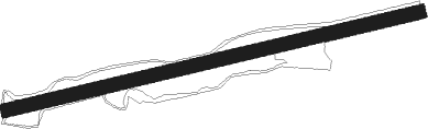
Runway info
| Runway 09 / 27 | ||
| length | 474m (1555ft) | |
| bearing | 83° / 263° | |
| width | 16m (53ft) | |
| surface | grass | |
Nearby beacons
| code | identifier | dist | bearing | frequency |
|---|---|---|---|---|
| SKU | STANWYCK (NEWBURGH) NDB | 2.3 | 219° | 261 |
| SW | NEELY (NEWBURGH) NDB | 10.4 | 250° | 335 |
| IGN | KINGSTON VOR/DME | 10.8 | 62° | 117.60 |
| PWL | PAWLING (POUGHKEEPSIE) VOR/DME | 22.5 | 63° | 114.30 |
| CMK | CARMEL VOR/DME | 25.9 | 123° | 116.60 |
| HUO | HUGUENOT VOR/DME | 27.3 | 255° | 116.10 |
| SAX | SPARTA VORTAC | 37.7 | 227° | 115.70 |
| TEB | TETERBORO VOR/DME | 42.8 | 184° | 108.40 |
| MM | MOREE (MORRISTOWN) NDB | 43.3 | 205° | 392 |
| PFH | PHILMONT (HUDSON) NDB | 43.6 | 23° | 272 |
| TE | TORBY (TETERBORO) NDB | 45.7 | 189° | 214 |
| BDR | BRIDGEPORT VOR/DME | 46.9 | 114° | 108.80 |
| LGA | LA GUARDIA (NEW YORK) VOR/DME | 47.1 | 169° | 113.10 |
| STW | STILLWATER VOR/DME | 51.2 | 236° | 109.60 |
| CAT | CHATHAM NDB | 52.6 | 207° | 254 |
| FR | FRIKK (FARMINGDALE) NDB | 52.9 | 146° | 407 |
| DNY | DE LANCEY VOR/DME | 56 | 303° | 112.10 |
| DPK | DEER PARK VOR/DME | 56.3 | 137° | 117.70 |
| JFK | KENNEDY (NEW YORK) VOR/DME | 56.8 | 165° | 115.90 |
| CRI | CANARSIE VOR/DME | 57.2 | 173° | 112.30 |
| BWZ | BROADWAY (SCHOOLEY'S MT) VOR/DME | 58.4 | 227° | 114.20 |
| SBJ | SOLBERG VOR/DME | 67.2 | 216° | 112.90 |
Disclaimer
The information on this website is not for real aviation. Use this data with the X-Plane flight simulator only! Data taken with kind consent from X-Plane 12 source code and data files. Content is subject to change without notice.