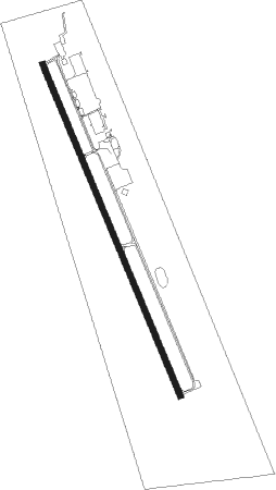
Cleveland - Cleveland Muni
Airport details
| Country | United States of America |
| State | Texas |
| Region | K4 |
| Airspace | Houston Oceanic Ctr |
| Municipality | Cleveland |
| Elevation | 146ft (45m) |
| Timezone | GMT -6 |
| Coordinates | 30.35645, -95.00803 |
| Magnetic var | |
| Type | land |
| Available since | X-Plane v10.40 |
| ICAO code | 6R3 |
| IATA code | n/a |
| FAA code | n/a |
Communication
| Cleveland Muni CTAF/UNICOM | 123.000 |
| Cleveland Muni HOUSTON Approach/Departure | 119.700 |
Nearby beacons
| code | identifier | dist | bearing | frequency |
|---|---|---|---|---|
| DAS | DAISETTA VORTAC | 21.3 | 115° | 116.90 |
| BVP | NIXIN (HOUSTON) NDB | 24.3 | 210° | 326 |
| CX | ALIBI (HOUSTON) NDB | 24.6 | 279° | 281 |
| IAH | HUMBLE (HOUSTON) VORTAC | 29.7 | 220° | 116.60 |
| UTS | HUNTSVILLE NDB | 37.9 | 303° | 308 |
| GDE | GOODHUE (BEAUMONT) NDB | 44.7 | 110° | 368 |
| EFD | ELLINGTON (HOUSTON) TACAN | 45.7 | 191° | 109.40 |
| MHF | TRINITY (SMITH POINT) VOR/DME | 50.5 | 162° | 113.60 |
| LFK | LUFKIN VORTAC | 50.6 | 20° | 112.10 |
| LF | FLUFY (LUFKIN) NDB | 52.6 | 12° | 350 |
| BPT | BEAUMONT VOR/DME | 57 | 112° | 114.50 |
| SBI | SABINE PASS VOR/DME | 64.5 | 125° | 115.40 |
| LOA | LEONA VORTAC | 67.6 | 309° | 110.80 |
Departure and arrival routes
| Transition altitude | 18000ft |
| Transition level | 18000ft |
| SID end points | distance | outbound heading | |
|---|---|---|---|
| ALL | |||
| PSX2 | 185mi | 258° | |
| RW16 | |||
| INDIE8 | 178mi | 31° | |
| LURIC8 | 176mi | 46° | |
| STRYA8 | 199mi | 75° | |
| MMALT5 | 143mi | 105° | |
| HOODO7 | 107mi | 135° | |
| WATFO5 | 139mi | 158° | |
| KARRR6 | 181mi | 222° | |
| BORRN4 | 88mi | 251° | |
| STYCK8 | 126mi | 327° | |
| BLTWY7 | 69mi | 327° | |
| WYLSN8 | 75mi | 335° | |
| RW34 | |||
| INDIE8 | 178mi | 31° | |
| LURIC8 | 176mi | 46° | |
| STRYA8 | 199mi | 75° | |
| MMALT5 | 143mi | 105° | |
| HOODO7 | 107mi | 135° | |
| WATFO5 | 139mi | 158° | |
| KARRR6 | 181mi | 222° | |
| BORRN4 | 88mi | 251° | |
| STYCK8 | 126mi | 327° | |
| BLTWY7 | 69mi | 327° | |
| WYLSN8 | 75mi | 335° | |
| STAR starting points | distance | inbound heading | |
|---|---|---|---|
| ALL | |||
| OHIIO4 | 13.6 | 19° | |
| WHAEL3 | 88.2 | 65° | |
| RIICE8 | 44.5 | 96° | |
| HUDZY4 | 18.3 | 322° | |
Instrument approach procedures
| runway | airway (heading) | route (dist, bearing) |
|---|---|---|
| RW16 | EAKES (123°) | EAKES HAWXE (12mi, 91°) 3000ft |
| RNAV | HAWXE 3000ft DUUPO (6mi, 159°) 2200ft ANLIC (4mi, 159°) 900ft 6R3 (3mi, 159°) 202ft (5665mi, 108°) 620ft KENNN (5657mi, 288°) 2000ft KENNN (turn) |
Holding patterns
| STAR name | hold at | type | turn | heading* | altitude | leg | speed limit |
|---|---|---|---|---|---|---|---|
| HUDZY4 | BRWCK | VHF | left | 55 (235)° | DME 20.0mi | ICAO rules | |
| HUDZY4 | WAPPL | VHF | left | 55 (235)° | DME 10.0mi | ICAO rules | |
| OHIIO4 | LYMBO | VHF | right | 71 (251)° | DME 20.0mi | ICAO rules | |
| OHIIO4 | ZEEKK | VHF | right | 46 (226)° | DME 10.0mi | ICAO rules | |
| RIICE8 | BAZBL | VHF | left | 313 (133)° | < 17999ft | 1.0min timed | ICAO rules |
| RIICE8 | CHMPZ | VHF | right | 340 (160)° | 1.0min timed | ICAO rules | |
| RIICE8 | HOMRN | VHF | right | 313 (133)° | < 17999ft | 1.0min timed | ICAO rules |
| RIICE8 | RIICE | VHF | right | 313 (133)° | < 60000ft | DME 10.0mi | ICAO rules |
| RIICE8 | TORNN | VHF | right | 334 (154)° | < 17999ft | 1.0min timed | ICAO rules |
| *) magnetic outbound (inbound) holding course | |||||||
Disclaimer
The information on this website is not for real aviation. Use this data with the X-Plane flight simulator only! Data taken with kind consent from X-Plane 12 source code and data files. Content is subject to change without notice.