Sycamore - Turner Co
Airport details
| Country | United States of America |
| State | Georgia |
| Region | K7 |
| Airspace | Jacksonville Ctr |
| Municipality | Turner County |
| Elevation | 389ft (119m) |
| Timezone | GMT -5 |
| Coordinates | 31.68572, -83.63219 |
| Magnetic var | |
| Type | land |
| Available since | X-Plane v10.40 |
| ICAO code | 75J |
| IATA code | n/a |
| FAA code | n/a |
Communication
| Turner Co CTAF/UNICOM | 122.700 |
Nearby Points of Interest:
Turner County Courthouse
-Turner County Jail
-Sumner High School and auditorium
-Possum Poke
-Poulan Library
-U.S. Post Office
-Worth County Courthouse
-Sylvester Local News
-Tifton Residential Historic District
-Tift County Courthouse
-Tifton Commercial Historic District
-Ben Hill County Courthouse
-Holtzendorf Apartments
-Ben Hill County Jail
-Ocilla Public School
-Irwin County Courthouse
-Wilcox County Courthouse
-Dooly County Courthouse
-Heritage Plaza
-Bridge House
-Rosenberg Brothers Department Store
-Nelson Tift Building
-Albany Municipal Auditorium
-Albany Theatre
Runway info
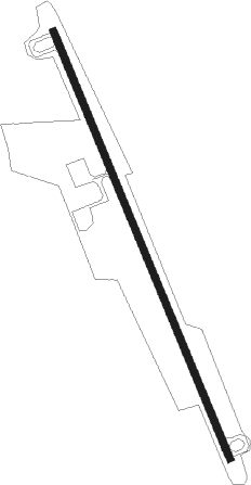
| Runway 17 / 35 | ||
| length | 1527m (5010ft) | |
| bearing | 159° / 339° | |
| width | 23m (75ft) | |
| surface | asphalt | |
| blast zone | 46m (151ft) / 46m (151ft) | |
Nearby beacons
| code | identifier | dist | bearing | frequency |
|---|---|---|---|---|
| IFM | TIFT MYERS (TIFTON) VOR | 17 | 151° | 112.50 |
| SUR | FITZGERALD NDB | 17.9 | 102° | 362 |
| OHY | CONEY (CORDELE) NDB | 22.1 | 324° | 400 |
| VNA | VIENNA VORTAC | 32.4 | 14° | 116.50 |
| PZD | PECAN (ALBANY) VOR/DME | 33.8 | 267° | 116.10 |
| EZM | EASTMAN NDB | 36.2 | 47° | 366 |
| MGR | DME | 37.2 | 196° | 108.80 |
| LKG | LINDBERGH (AMERICUS) NDB | 38 | 316° | 242 |
| ACJ | SOUTHER (AMERICUS) NDB | 38.1 | 308° | 242 |
| OWC | COFFEE COUNTY (DOUGLAS) NDB | 39.9 | 112° | 390 |
| GTP | PATON (THOMASVILLE) NDB | 44.8 | 195° | 245 |
| IZS | MONTEZUMA NDB | 45.1 | 331° | 426 |
| MQW | MC RAE NDB | 45.4 | 61° | 280 |
| VAD | MOODY (VALDOSTA) TACAN | 49 | 149° | 113.30 |
| AZE | HAZLEHURST NDB | 51.6 | 79° | 414 |
| CYR | CAIDY (CAIRO) NDB | 55 | 213° | 338 |
| OTK | VALDOSTA VOR/DME | 57.3 | 159° | 114.80 |
| DB | CREKE (DUBLIN) NDB | 57.4 | 38° | 251 |
| WRB | ROBINS (WARNER ROBINS) TACAN | 57.4 | 2° | 135.30 |
| HOE | HOMERVILLE NDB | 58.1 | 126° | 209 |
| LYZ | WILLIS (BAINBRIDGE) NDB | 62.7 | 231° | 359 |
| DBN | DUBLIN VORTAC | 66.6 | 42° | 113.10 |
Instrument approach procedures
| runway | airway (heading) | route (dist, bearing) |
|---|---|---|
| RW17 | CRAGS (159°) | CRAGS 2500ft |
| RNAV | CRAGS 2500ft CAPUP (5mi, 159°) 2100ft LIPME (3mi, 159°) 1220ft 75J (3mi, 159°) 439ft (5080mi, 111°) 789ft SEISE (5076mi, 291°) 2500ft SEISE (turn) | |
| RW35 | SEISE (339°) | SEISE 2500ft |
| RNAV | SEISE 2500ft FAMID (5mi, 339°) 2100ft TRANK (3mi, 339°) 1060ft 75J (2mi, 339°) 438ft (5080mi, 111°) 780ft CRAGS (5084mi, 291°) 2500ft CRAGS (turn) |
Disclaimer
The information on this website is not for real aviation. Use this data with the X-Plane flight simulator only! Data taken with kind consent from X-Plane 12 source code and data files. Content is subject to change without notice.