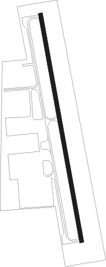
Creswell - Hobby Fld
Airport details
| Country | United States of America |
| State | Oregon |
| Region | K1 |
| Airspace | Seattle Ctr |
| Municipality | Creswell |
| Elevation | 538ft (164m) |
| Timezone | GMT -8 |
| Coordinates | 43.93075, -123.00667 |
| Magnetic var | |
| Type | land |
| Available since | X-Plane v10.40 |
| ICAO code | 77S |
| IATA code | n/a |
| FAA code | n/a |
Communication
| HOBBY FLD CTAF/UNICOM | 122.700 |
Nearby Points of Interest:
Methodist Episcopal Church of Goshen
-Jacob Clearwater House
-Wayne Morse Farm
-Southern Pacific Railroad Passenger Station and Freight House
-Brattain–Hadley House
-Clarence and Ethel Boyer House
-Springfield General Hospital
-Howard A. Hall House
-Benjamin Franklin Dorris House
-Knight Library
-Johnson Hall
-Robert E. Campbell House
-Patterson–Stratton House
-Christian–Patterson Rental Property
-Deady and Villard Halls
-Dads' Gates
-First Congregational Church
-A. V. Peters House
-Alpha Phi Sorority House
-Wilder Apartments
-Windsor W. Calkins House
-Gamma Phi Beta Sorority House
-Old Beta Theta Pi Fraternity House
-Cochran-Rice Farm Complex
-Daniel and Catherine Christian House
Nearby beacons
| code | identifier | dist | bearing | frequency |
|---|---|---|---|---|
| EUG | EUGENE VORTAC | 14.7 | 311° | 112.90 |
| CVO | CORVALLIS VOR/DME | 36.3 | 333° | 115.40 |
| LWG | LEWISBURG (CORVALLIS) NDB | 42.5 | 339° | 225 |
| RBG | ROSEBURG VOR/DME | 47.3 | 205° | 108.20 |
| SL | TURNO (SALEM) NDB | 55.1 | 3° | 266 |
Departure and arrival routes
| Transition altitude | 18000ft |
| Transition level | 18000ft |
| SID end points | distance | outbound heading | |
|---|---|---|---|
| RW34 | |||
| 77S2 | 15mi | 311° | |
Instrument approach procedures
| runway | airway (heading) | route (dist, bearing) |
|---|---|---|
| RW16 | ALFOR (159°) | ALFOR IYAYE (10mi, 144°) 3800ft |
| RNAV | IYAYE 3800ft WOSLO (2mi, 172°) 3700ft ZEMAM (2mi, 172°) 3500ft UWZAB (4mi, 172°) 2160ft 77S (5mi, 172°) 581ft (6792mi, 110°) 941ft CURTI (6804mi, 290°) 6000ft CURTI (turn) 6000ft |
Disclaimer
The information on this website is not for real aviation. Use this data with the X-Plane flight simulator only! Data taken with kind consent from X-Plane 12 source code and data files. Content is subject to change without notice.
