Philippi - Philippi/barbour Cty
Airport details
| Country | United States of America |
| State | West Virginia |
| Region | K6 |
| Airspace | Washington Ctr |
| Municipality | Philippi |
| Elevation | 1754ft (535m) |
| Timezone | GMT -5 |
| Coordinates | 39.16619, -80.06235 |
| Magnetic var | |
| Type | land |
| Available since | X-Plane v10.40 |
| ICAO code | 79D |
| IATA code | n/a |
| FAA code | 79D |
Communication
| Philippi/Barbour Cty Philippi CTAF | 129.000 |
| Philippi/Barbour Cty Philippi - Clarksburg Approach | 121.150 |
| Philippi/Barbour Cty Philippi - Clarksburg Departure | 121.150 |
Nearby Points of Interest:
Whitescarver Hall
-Philippi B & O Railroad Station
-Peck-Crim-Chesser House
-Barbour County Courthouse
-Adaland
-J.N.B. Crim House
-Carrollton Covered Bridge
-Anna Jarvis House
-Templemoor
-Bernard E. Wilmoth House
-Grafton Downtown Commercial Historic District
-Governor Joseph Johnson House
-William Post Mansion
-Agnes Howard Hall
-Downtown Buckhannon Historic District
-Buckhannon Central Residential Historical District
-Southern Methodist Church Building
-Lost Creek Baltimore and Ohio Railroad Depot
-Daniel Bassel House
-Clelland House
-Waldomore
-Watters Smith Memorial State Park
-West Virginia Children's Home
-Pinecrest
-Graceland
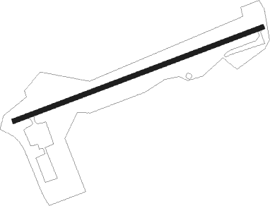
Runway info
| Runway 8 / 26 | ||
| length | 996m (3268ft) | |
| bearing | 77° / 257° | |
| width | 18m (60ft) | |
| surface | asphalt | |
| displ threshold | 43m (141ft) / 69m (226ft) | |
Nearby beacons
| code | identifier | dist | bearing | frequency |
|---|---|---|---|---|
| CKB | CLARKSBURG VOR/DME | 10.8 | 293° | 112.60 |
| EKN | ELKINS VORTAC | 15.2 | 188° | 114.20 |
| RQY | RANDOLPH CO. (ELKINS) NDB | 18.8 | 143° | 284 |
| MGW | MORGANTOWN VOR/DME | 25.2 | 27° | 111.60 |
| VV | CAMOR (CONNELLSVILLE) NDB | 45.4 | 24° | 299 |
| IHD | INDIAN HEAD VORTAC | 58.4 | 41° | 108.20 |
| AIR | BELLAIRE VOR/DME | 61.8 | 318° | 117.10 |
Instrument approach procedures
| runway | airway (heading) | route (dist, bearing) |
|---|---|---|
| RW26 | CKB (113°) | CKB UCOYA (17mi, 87°) 4500ft UCOYA (turn) 4500ft |
| RW26 | UGJOB (252°) | UGJOB UCOYA (4mi, 292°) 4500ft |
| RNAV | UCOYA 4500ft TUGOY (5mi, 226°) 3500ft JUBVI (4mi, 246°) 1948ft (4943mi, 116°) 2155ft UCOYA (4936mi, 296°) 4500ft UCOYA (turn) |
Disclaimer
The information on this website is not for real aviation. Use this data with the X-Plane flight simulator only! Data taken with kind consent from X-Plane 12 source code and data files. Content is subject to change without notice.