Scales Mound - Foster Field
Airport details
| Country | United States of America |
| State | Illinois |
| Region | K5 |
| Airspace | Chicago Ctr |
| Municipality | Apple River Township |
| Elevation | 990ft (302m) |
| Timezone | GMT -6 |
| Coordinates | 42.46645, -90.16939 |
| Magnetic var | |
| Type | land |
| Available since | X-Plane v10.40 |
| ICAO code | 7A4 |
| IATA code | n/a |
| FAA code | IL28 |
Communication
Nearby Points of Interest:
Gratiot House
-Water Street Commercial Historic District
-Townsend Home
-Warren Commercial Historic District
-Chicago Great Western Railroad Depot
-W.E. White Building
-Charles Wenner House
-Hazel Green Town Hall
-Lafayette County Courthouse
-Kellogg's Grove
-Building at 101 North Riverview Street
-Building at 130–132 North Riverview Street
-Bellevue Herald Building
-Building at 126 South Riverview Street
-Kucheman Building
-Building at 306 South Second Street
-House at 505 Court Street
-Henry Roling House
-William Dyas Barn
-Dyas Hexagonal Barn
-Saint Donatus Catholic Church
-Gehlen House and Barn
-Fritz Chapel
-Henry N. Frentess Farmstead
-Star Theater
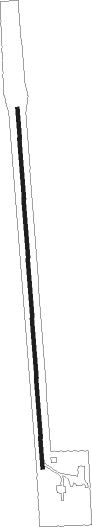
Runway info
| Runway 18 / 36 | ||
| length | 914m (2999ft) | |
| bearing | 181° / 1° | |
| width | 9m (30ft) | |
| surface | asphalt | |
| displ threshold | 67m (220ft) / 16m (52ft) | |
Nearby beacons
| code | identifier | dist | bearing | frequency |
|---|---|---|---|---|
| DB | ZILOM (DUBUQUE) NDB | 20.9 | 252° | 341 |
| DBQ | DUBUQUE VORTAC | 24.2 | 263° | 115.80 |
| PLL | POLO VOR/DME | 41.5 | 128° | 111.20 |
| FN | HILLZ (CLINTON) NDB | 44 | 197° | 517 |
| RFD | DME | 45.4 | 104° | 110.80 |
| CVA | DAVENPORT VORTAC | 47.6 | 202° | 113.80 |
| LNR | ROCK DME | 49.7 | 3° | 116.05 |
| MSN | MADISON VORTAC | 54.7 | 51° | 108.60 |
Disclaimer
The information on this website is not for real aviation. Use this data with the X-Plane flight simulator only! Data taken with kind consent from X-Plane 12 source code and data files. Content is subject to change without notice.